| Colagne | |
|---|---|
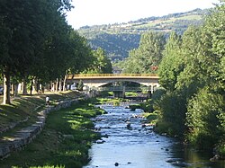 The Colagne at Marvejols | |
| Location | |
| Country | France |
| Physical characteristics | |
| Source | |
| • location | Arzenc-de-Randon |
| • coordinates | 44°38′40″N 03°35′39″E / 44.64444°N 3.59417°E / 44.64444; 3.59417 |
| • elevation | 1,380 m (4,530 ft) |
| Mouth | |
• location | Lot |
• coordinates | 44°29′25″N 03°14′44″E / 44.49028°N 3.24556°E / 44.49028; 3.24556 |
• elevation | 590 m (1,940 ft) |
| Length | 58.4 km (36.3 mi) |
Basin size | 456 km2 (176 sq mi) |
| Discharge | |
| • average | 5.08 m3/s (179 cu ft/s) |
| Basin features | |
| Progression |
Lot→ Garonne→ Gironde estuary→ Atlantic Ocean |
The Colagne (French pronunciation: [kɔlaɲ]) is a 58.4-kilometre (36.3 mi) long river in the Lozère département, southeastern France.1 Its source is in Arzenc-de-Randon. It flows generally southwest. It is a right tributary of the Lot into which it flows between Saint-Bonnet-de-Chirac and Le Monastier-Pin-Moriès.
Communes along its course
This list is ordered from source to mouth: