| Chismore Range | |
|---|---|
 | |
| Highest point | |
| Elevation | 432 m (1,417 ft) |
| Dimensions | |
| Area | 22 km2 (8.5 mi2) |
| Geography | |
Country | Canada |
Province | British Columbia |
Range coordinates | 53°59′N 130°16′W / 53.983°N 130.267°W / 53.983; -130.267 |
| Parent range | Kitimat Ranges |
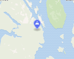
The Chismore Range is a small subrange of the Kitimat Ranges, located on the western edge of Porcher Island, British Columbia, Canada.
References
References
- "Chismore Range". BC Geographical Names. Government of British Columbia – B.C. Geographical Names Office (BCGNO).
- Chismore Range in the Canadian Mountain Encyclopedia
- Natural Resources Canada
- mapcarta
- updated weather