| Carnarvon | |
|---|---|
 | |
| Dimensions | |
| Length | 160 km (99 mi) |
| Geography | |
 | |
Country | Australia |
State | Queensland |
Region | Central Queensland |
Range coordinates | 25°23.8′S 148°36.8′E / 25.3967°S 148.6133°E / -25.3967; 148.6133 |
| Parent range | Great Dividing Range |
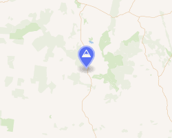
The Carnarvon Range is a mountain range in Central Queensland, Australia. It is a plateau section of the Great Dividing Range. The Carnarvon Range is 160 km in length.1
Geography
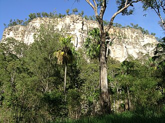
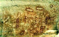
North eastern parts of the range have formed a plateau known as the Consuelo Tableland. The plateau contains Aboriginal paintings and sandstone gorges, including in the Carnarvon Gorge. Part of the range is protected within the Carnarvon National Park.2
The range marks the northernmost limits of the Murray-Darling Basin and is the headwaters for a number of rivers including the Fitzroy River, Warrego River, Dawson River, Merivale River and the Nogoa River.
History
Gungabula (also known as Kongabula and Khungabula) is an Australian Aboriginal language of the headwaters of the Dawson River in Central Queensland. The language region includes areas within the local government area of Maranoa Region, particularly the towns of Charleville, Augathella and Blackall and as well as the Carnarvon Range.3
It was first explored by Ludwig Leichhardt but named by Thomas Mitchell, probably after the 4th Earl of Carnarvon.4
Environment
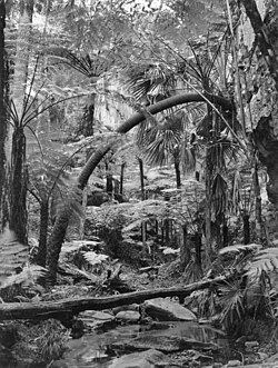
The cycad species Macrozamia moorei is a native plant species found naturally in the Carnarvon Range.
References
References
- "Carnarvon Range (plateau, Queensland, Australia)". Encyclopædia Britannica. Britannica Online Encyclopedia. Retrieved 22 June 2009.
- "Mount Moffatt, Carnarvon National Park". Queensland Government Department of Environment and Science. Retrieved 30 January 2019.
-
 This Wikipedia article incorporates CC BY 4.0 licensed text from: "Gungabula". Queensland Aboriginal and Torres Strait Islander languages map. State Library of Queensland. Retrieved 28 January 2020.
- "Carnarvon Gorge - Human history". Carnarvon Gorge Discovery Centre. Retrieved 30 January 2019.