Balaghat | |
|---|---|
City | |
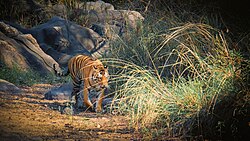 Indian Tiger in Kanha Tiger Reserve 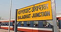 Balaghat Junction Railway Station 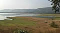 Gangulpara Reservoir Balaghat | |
Balaghat Location in Madhya Pradesh, India Show map of Madhya PradeshBalaghat Balaghat (India) Show map of India | |
| Coordinates: 21°48′N 80°11′E / 21.8°N 80.18°E / 21.8; 80.18 | |
| Country | |
| State | Madhya Pradesh |
| District | Balaghat |
| Government | |
| • Type | Municipal Council |
| • Body | Balaghat Municipal Council |
| Elevation | 288 m (945 ft) |
| Population (2011) | |
• Total | 84,261 |
| Languages | |
| • Official | 1)Hindi (Primary) 2)English (Additional) 3)Powari (पोवारी) language (language of Powar/Panwar people's), 4) Gondi (caste language of schedule tribes people's), Chattisgarhi language (speaking in northeastern part of balaghat), 5) Marathi (speaking by some marathi communities in south part of Balaghat) |
| Time zone | UTC+5:30 (IST) |
| PIN | 481001 |
| ISO 3166 code | IN-MP |
| Vehicle registration | MP-50 |
| Website | balaghat |
Balaghat is a city and a municipality in Balaghat district, in the state of Madhya Pradesh, India. It is the administrative headquarters of Balaghat District. Wainganga River flows beside the town. The nearest airport is Birsi (Gondia).1
The headquarters of the district was originally called "Burha" or "बूढ़ा". Later, however, this name fell into disuse and was replaced by "Balaghat", which was originally the name of the district only. Balaghat is known for its tile factories, rice mills and forests.2
Geography
Balaghat is located at 21°48′N 80°11′E / 21.800°N 80.183°E / 21.800; 80.183.3 It has an average elevation of 288 metres (944 feet).
Balaghat is surrounded by dense forests of Satpura, Wainganga River flows through Balaghat.
Demographics
As of the 2011 Census of India,4 Balaghat had a population of 84,216. Males constitute 51% of the population and females 49%. 11% of the population is under 6 years of age.
Government
Balaghat Is part of Balaghat Assembly constituency,5 in 2023 Madhya Pradesh Legislative Assembly election Anubha Munjare is elected mla from Indian National Congress. Entire assembly is part of Balaghat Lok Sabha constituency in 2024 Bharti Pardhi is elected mp from balaghat lok sabha.6
Education Institute
Many Govt and Private School situated in balaghat, There are number of educational institutions in Balaghat, such as a Government Boys and Government Girls schools.7
Many higher education college are available in balaghat belongs to Rani Durgawati University Jabalpur.8
- Sardar Patel University, Balaghat
- JataShankar Trivedi Government P.G. College, Balaghat
- Government Kamla Nehru Girls College, Balaghat
- Govt. Polytechnic College, Balaghat
Economy
Balaghat's economy relies primarily on agriculture, minerals, and forest wealth. It is considered one of the prosperous districts of Madhya Pradesh.9
Industrial Status: Heavy industries are lacking in Balaghat, but rice mills, tile factories and mineral-based small industries are plentiful. Malajkhand has Asia's largest open-pit copper mine, operated by Hindustan Copper Limited.10
Notable people
Transport
Balaghat is connected with Railway and Roadways, Balaghat junction railway station is major railway station of city, Jabalpur - Gondia railline passing through balaghat. Many trains halting in here.11
References
References
- "Nagar Palika Balaghat". Retrieved 18 September 2025.
- "District Balaghat, Government of Madhya Pradesh | India". Retrieved 10 April 2023.
- "Maps, Weather, and Airports for Balaghat, India". www.fallingrain.com. Retrieved 18 September 2025.
- "Census of India 2001: Data from the 2011 Census, including cities, villages and towns (Provisional)". Census Commission of India. Archived from the original on 16 June 2004. Retrieved 1 November 2008.
- "List of Assembly Constituencies". eci.nic.in. Election Commission of India. Retrieved 18 May 2018.
- Desk, India Today News (4 June 2024). "Balaghat, Madhya Pradesh Lok Sabha Election Results 2024 Highlights: Bharti Pardhi Wins by a Margin of 174512 Votes". India Today. Retrieved 18 September 2025.
{{cite web}}:|last=has generic name (help) - https://balaghat.nic.in/en/education/
- https://balaghat.nic.in/en/public-utility-category/colleges-universities/
- https://www.mptradeportal.org/balaghat
- https://balaghat.nic.in/en/economy/
- "32 Departures from Balaghat SECR/South East Central Zone - Railway Enquiry". indiarailinfo.com. Retrieved 18 September 2025.