Bainet
Benè | |
|---|---|
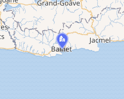 Interactive map of Bainet | |
Bainet Location in Haiti | |
| Coordinates: 18°11′0″N 72°45′0″W / 18.18333°N 72.75000°W / 18.18333; -72.75000 | |
| Country | Haiti |
| Department | Sud-Est |
| Arrondissement | Bainet |
| Area | |
• Total | 300.6 km2 (116.1 sq mi) |
| Elevation | 0 m (0 ft) |
| Population (2015)1 | |
• Total | 86,755 |
| • Density | 288.6/km2 (747.5/sq mi) |
| Time zone | UTC−05:00 (EST) |
| • Summer (DST) | UTC−04:00 (EDT) |
| Postal code | HT 9210 |
Bainet (French pronunciation: [benɛ]; Haitian Creole: Benè) is a commune in the Bainet Arrondissement, in the Sud-Est department of Haiti. It has 86,755 inhabitants as of 2015.
History
In late 1791 and early 1792, during the early Haitian Revolution, slaves in Bainet rebelled as part of the Trou Coffy uprising led by Romaine-la-Prophétesse.2
The commune's administrative offices were destroyed as a result of the 2010 Haiti earthquake. As a result, from 2010 to 2016, city officials worked in prefabricated premises funded by the United Nations Stabilisation Mission in Haiti (MINUSTAH). MINUSTAH ultimately funded the creation of a new town hall, which was inaugurated in October 2016.3
Notable person
The Haitian artist and photographer Gérald Bloncourt was born in Bainet.4
References
References
- "POPULATION TOTALE, POPULATION DE 18 ANS ET PLUS - MÉNAGES ET DENSITÉS ESTIMÉS EN 2015" (PDF).
- Rey, Terry (2017). The Priest and the Prophetess: Abbé Ouvière, Romaine Rivière, and the Revolutionary Atlantic World. Oxford University Press. pp. 36, 55. ISBN 978-0190625849.
- "Haiti - Reconstruction : New town hall in Bainet". Haiti Libre. 2016-10-01. Retrieved 2023-12-19.
- Eleanor Ingalls Christensen, The Art of Haiti (1975), page 64