Arné | |
|---|---|
 Coat of arms | |
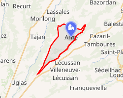 Location of Arné | |
Arné Arné | |
| Coordinates: 43°11′11″N 0°30′22″E / 43.1864°N 0.5061°E / 43.1864; 0.5061 | |
| Country | France |
| Region | Occitania |
| Department | Hautes-Pyrénées |
| Arrondissement | Bagnères-de-Bigorre |
| Canton | La Vallée de la Barousse |
| Intercommunality | CC Plateau de Lannemezan |
| Government | |
| • Mayor (2020–2026) | Lionel Cazaux1 |
Area 1 | 8.34 km2 (3.22 sq mi) |
| Population (2023)2 | 181 |
| • Density | 21.7/km2 (56.2/sq mi) |
| Time zone | UTC+01:00 (CET) |
| • Summer (DST) | UTC+02:00 (CEST) |
| INSEE/Postal code | 65028 /65670 |
| Elevation | 414–564 m (1,358–1,850 ft) (avg. 420 m or 1,380 ft) |
| 1 French Land Register data, which excludes lakes, ponds, glaciers > 1 km2 (0.386 sq mi or 247 acres) and river estuaries. | |
Arné (French pronunciation: [aʁne]; Occitan: Arnèr) is a commune in the Hautes-Pyrénées department in southwestern France.
Geography
The river Gesse has its source in the southern part of the commune and forms most of its eastern border.
Population
| Year | Pop. | ±% p.a. |
|---|---|---|
| 1968 | 257 | — |
| 1975 | 234 | −1.33% |
| 1982 | 199 | −2.29% |
| 1990 | 188 | −0.71% |
| 1999 | 187 | −0.06% |
| 2009 | 199 | +0.62% |
| 2014 | 214 | +1.46% |
| 2020 | 198 | −1.29% |
| Source: INSEE3 | ||
References
References
- "Répertoire national des élus: les maires" (in French). data.gouv.fr, Plateforme ouverte des données publiques françaises. 13 September 2022.
- "Populations de référence 2023" (in French). National Institute of Statistics and Economic Studies. 18 December 2025.
- Population en historique depuis 1968, INSEE