
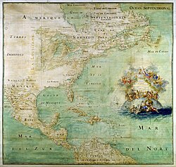

The cartography of the United States is the history of surveying and creation of maps of the United States. Maps of the New World had been produced since the 16th century. The history of cartography of the United States began in the 18th century, after the declared independence of the original Thirteen Colonies on July 4, 1776, during the American Revolutionary War (1776–1783). Later, Samuel Augustus Mitchell published a map of the United States in 1850.1 The National Program for Topographic Mapping was initiated in 1884 by the United States Geological Survey (USGS).2
See also
See also
References
References
- "1850 Mitchell Map of North America". Geographicus Rare Antique Maps.
- "Esri Industries | GIS Industry Solutions". www.esri.com. Retrieved July 5, 2025.
Further reading
Further reading
- S. Max Edelson, The New Map of Empire: How Britain Imagined America Before Independence. Cambridge, Massachusetts: Harvard University Press, 2017
- Susan Schulten, Mapping the Nation: History and Cartography in Nineteenth-Century America. Chicago, Illinois: University of Chicago Press, 2012
External links
External links
- Media related to Maps of the United States at Wikimedia Commons
- 125 Years of Topographic Mapping Archived December 1, 2017, at the Wayback Machine