Zenting | |
|---|---|
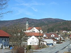 View of Zenting. Behind: the Aschenstein (l) and the Geißlstein | |
 Coat of arms | |
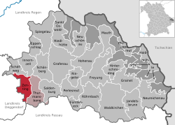
Location of Zenting
within Freyung-Grafenau district | |
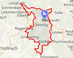 Location of Zenting | |
Zenting Zenting | |
| Coordinates: 48°48′N 13°16′E / 48.800°N 13.267°E / 48.800; 13.267 | |
| Country | Germany |
| State | Bavaria |
| Admin. region | Niederbayern |
| District | Freyung-Grafenau |
| Municipal assoc. | Thurmansbang |
| Government | |
| • Mayor (2020–26) | Dirk Rohowski1 (FW) |
| Area | |
• Total | 21.74 km2 (8.39 sq mi) |
| Elevation | 450 m (1,480 ft) |
| Population (2024-12-31)2 | |
• Total | 1,159 |
| • Density | 53.31/km2 (138.1/sq mi) |
| Time zone | UTC+01:00 (CET) |
| • Summer (DST) | UTC+02:00 (CEST) |
| Postal codes | 94579 |
| Dialling codes | 09907 |
| Vehicle registration | FRG |
| Website | www.zenting.de |
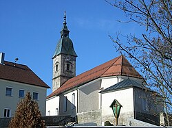
Zenting is a municipality in the district of Freyung-Grafenau in Bavaria in Germany.
Location
This municipality lies in the region of the Danube Forest (Donau-Wald) in the middle of the Bavarian Forest. The village nestles in a sunny, south-facing bowl, above which the Brotjacklriegel (1,016 m) and Aschenstein (945 m) tower to the north. Zenting is located around 35 km NW of Passau, 13 km from Tittling, 18 km SW of Grafenau, 26 km N of Vilshofen an der Donau and 15 km from the A 3 (Iggensbach exit).
References
References
- Liste der ersten Bürgermeister/Oberbürgermeister in kreisangehörigen Gemeinden, Bayerisches Landesamt für Statistik, 15 July 2021.
- "Gemeinden, Kreise und Regierungsbezirke in Bayern, Einwohnerzahlen am 31. Dezember 2024; Basis Zensus 2022" [Municipalities, counties, and administrative districts in Bavaria; Based on the 2022 Census] (CSV) (in German). Bayerisches Landesamt für Statistik.