Wangerland | |
|---|---|
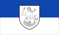 Flag 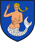 Coat of arms | |
Location of Wangerland
within Friesland district | |
 Location of Wangerland | |
Wangerland Wangerland | |
| Coordinates: 53°39′N 7°57′E / 53.650°N 7.950°E / 53.650; 7.950 | |
| Country | Germany |
| State | Lower Saxony |
| District | Friesland |
| Subdivisions | 14 quarters |
| Government | |
| • Mayor (2021–26) | Mario Szlezak1 (SPD) |
| Area | |
• Total | 176.19 km2 (68.03 sq mi) |
| Elevation | 2 m (6.6 ft) |
| Population (2024-12-31)2 | |
• Total | 9,149 |
| • Density | 51.93/km2 (134.5/sq mi) |
| Time zone | UTC+01:00 (CET) |
| • Summer (DST) | UTC+02:00 (CEST) |
| Postal codes | 26434, 26441 (Groß Hauskreuz) |
| Dialling codes | 04463, 04464, 04461, 04425, 04426 |
| Vehicle registration | FRI |
| Website | www.wangerland-online.de |

Wangerland (German pronunciation: [ˈvaŋɐˌlant]) is a municipality in the district of Friesland, Lower Saxony, Germany. It is situated on the North Sea coast, approximately 20 km northwest of Wilhelmshaven, and 10 km north of Jever. Its seat is in the village Hohenkirchen.
History
First settlements are dated on the 2nd century B.C.
Subdivision
The municipality consists of the following villages: Altgarmssiel, Förrien, Friederikensiel, Hohenkirchen, Hooksiel, Horumersiel, Middoge, Minsen, Neugarmssiel, Oldorf, Schillig, Tettens, Waddewarden and Wiarden.3
References
References
- "Stichwahlen zu Direktwahlen in Niedersachsen vom 26. September 2021" (PDF). Landesamt für Statistik Niedersachsen. 13 October 2021.
- "Tabelle EVAS 12411, Fortschreibung des Bevölkerungsstandes auf Basis des Zensus 2022, Stand 31. Dezember 2024" (in German). Landesamt für Statistik Niedersachsen.
- Ortschaften on Wangerland.de (German)