Wangenried | |
|---|---|
 Flag  Coat of arms | |
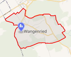 Location of Wangenried | |
Wangenried Wangenried | |
| Coordinates: 47°13′N 7°39′E / 47.217°N 7.650°E / 47.217; 7.650 | |
| Country | Switzerland |
| Canton | Bern |
| District | Oberaargau |
| Government | |
| • Executive | Gemeinderat with 5 members |
| • Mayor | Gemeindepräsident |
| Area | |
• Total | 2.9 km2 (1.1 sq mi) |
| Elevation | 473 m (1,552 ft) |
| Population (December 2020) | |
• Total | 407 |
| • Density | 140/km2 (360/sq mi) |
| Time zone | UTC+01:00 (CET) |
| • Summer (DST) | UTC+02:00 (CEST) |
| Postal code | 3374 |
| SFOS number | 993 |
| ISO 3166 code | CH-BE |
| Surrounded by | Deitingen (SO), Inkwil, Röthenbach bei Herzogenbuchsee, Subingen (SO), Walliswil bei Wangen, Wangen an der Aare |
| Website | www.wangenried.ch |
Wangenried is a former municipality in the Oberaargau administrative district in the canton of Bern in Switzerland. On 1 January 2024 the former municipality of Wangenried merged to form the municipality of Wangen an der Aare.
Geography
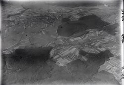
Wangenried has an area of 2.9 km2 (1.1 sq mi). Of this area, 67.9% is used for agricultural purposes, while 24.1% is forested. Of the rest of the land, 6.9% is settled (buildings or roads) and the remainder (1%) is non-productive (rivers, glaciers or mountains).2
Demographics
Wangenried has a population (as of 31 December 2020) of 407.3 As of 2007, 3.5% of the population was made up of foreign nationals. Over the last 10 years the population has grown at a rate of 6.1%. Most of the population (as of 2000) speaks German (97.9%), with Italian being second most common ( 0.8%) and French being third ( 0.5%).
In the 2007 election the most popular party was the SVP which received 53.1% of the vote. The next three most popular parties were the SPS (17.4%), the FDP (10.8%) and the local small left-wing parties (6.6%).
The age distribution of the population (as of 2000) is children and teenagers (0–19 years old) make up 23% of the population, while adults (20–64 years old) make up 61.3% and seniors (over 64 years old) make up 15.7%. In Wangenried about 76.9% of the population (between age 25-64) have completed either non-mandatory upper secondary education or additional higher education (either university or a Fachhochschule).
Wangenried has an unemployment rate of 0.66%. As of 2005, there were 36 people employed in the primary economic sector and about 13 businesses involved in this sector. 46 people are employed in the secondary sector and there are 3 businesses in this sector. 42 people are employed in the tertiary sector, with 7 businesses in this sector.2
References
References
- "Arealstatistik Standard - Gemeinden nach 4 Hauptbereichen" (in German). Federal Statistical Office. Retrieved 13 January 2019.
- Swiss Federal Statistical Office accessed 22-Jul-2009
- "Ständige und nichtständige Wohnbevölkerung nach institutionellen Gliederungen, Geburtsort und Staatsangehörigkeit". bfs.admin.ch (in German). Swiss Federal Statistical Office - STAT-TAB. 31 December 2020. Retrieved 21 September 2021.