Wallhalben | |
|---|---|
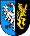 Coat of arms | |
Location of Wallhalben
within Südwestpfalz district
| |
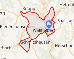 Location of Wallhalben | |
Wallhalben Wallhalben | |
| Coordinates: 49°19′1″N 7°31′38″E / 49.31694°N 7.52722°E / 49.31694; 7.52722 | |
| Country | Germany |
| State | Rhineland-Palatinate |
| District | Südwestpfalz |
| Municipal assoc. | Thaleischweiler-Wallhalben |
| Government | |
| • Mayor (2019–24) | Christine Burkhard1 |
| Area | |
• Total | 4.87 km2 (1.88 sq mi) |
| Elevation | 312 m (1,024 ft) |
| Population (2024-12-31)2 | |
• Total | 859 |
| • Density | 176/km2 (457/sq mi) |
| Time zone | UTC+01:00 (CET) |
| • Summer (DST) | UTC+02:00 (CEST) |
| Postal codes | 66917 |
| Dialling codes | 06375 |
| Vehicle registration | PS |
| Website | www.wallhalben.de |
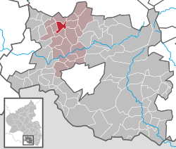
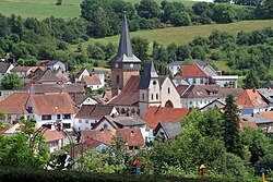
Wallhalben is a municipality in the Südwestpfalz district, in Rhineland-Palatinate, Germany. It is situated approximately 15 km northwest of Pirmasens, and 15 km northeast of Zweibrücken.
Until 1 July 2014, when it became part of the Verbandsgemeinde ("collective municipality") Thaleischweiler-Wallhalben, Wallhalben was the seat of the Verbandsgemeinde Wallhalben.
References
References
- Direktwahlen 2019, Landkreis Südwestpfalz, Landeswahlleiter Rheinland-Pfalz, accessed 9 August 2021.
- "Bevölkerungsstand von Land, Landkreisen, Gemeinden und Verbandsgemeinden 2024 (Einwohnerzahlen auf Grundlage des Zensus 2022)" (in German). Statistisches Landesamt Rheinland-Pfalz.