| Waginger See | |
|---|---|
 | |
Waginger See | |
| Location | Alpine foothills, Bavaria |
| Coordinates | 47°56′19″N 12°46′39″E / 47.93861°N 12.77750°E / 47.93861; 12.77750 |
| Tenglinger Bach, Höllenbach, Schinderbach | |
| Götzinger Achen | |
| 163.66 km2 (63.19 sq mi) | |
| Basin countries | Germany |
Surface area | 8.97 km2 (3.46 sq mi) |
| Max. depth | 27 m (89 ft) |
Surface elevation | 441 m (1,447 ft) |
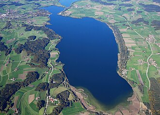
Waginger See (German pronunciation: [ˈvaːɡɪŋɐ ˈzeː]) is a lake in the Alpine foothills, Bavaria, Germany. Geologically, it forms one single lake with the Tachinger See, with which it is connected through a narrow strait at Tettenhausen. The surface area of the Waginger See proper is 6.61 km2 (2.55 sq mi); combined with the Tachinger See it is 8.97 km2 (3.46 sq mi).1 Its elevation is 441 m (1,447 ft) and its drainage area is 163.66 km2 (63.19 sq mi). Its primary inflows are Schinderbach, Höllenbach and Tenglinger Bach, and it is drained by the Götzinger Achen.1
References
References
- Nixdorf, B.; et al. (2004), "Waginger See", Dokumentation von Zustand und Entwicklung der wichtigsten Seen Deutschlands (in German), Berlin: Umweltbundesamt, p. 88