Umm Ramool
أم رمول | |
|---|---|
Community | |
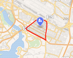 Interactive map of Umm Ramool | |
| Coordinates: 25°13′53″N 55°22′11″E / 25.23150°N 55.36963°E / 25.23150; 55.36963 | |
| Country | United Arab Emirates |
| Emirate | Dubai |
| City | Dubai |
| Area | Al Rashidiya |
| Area | |
• Total | 3.61 km2 (1.39 sq mi) |
| Population 1 (2000) | |
• Total | 4,629 |
| • Density | 1,280/km2 (3,320/sq mi) |
Umm Ramool (Arabic: أم رمول) is a locality in Dubai, United Arab Emirates (UAE). It is located in Deira in eastern Dubai and is bordered to the north by Dubai International Airport, to the east by Nad Shamma, to the west by Al Garhoud and to the south by Ras Al Khor. Umm Ramool is a residential and commercial community.
Umm Ramool is one of the oldest industrial areas in Dubai. The area was connected to the Dubai Metro Red Line with the opening of the Emirates Station on 30 April 2010.2 The station is connected to the Emirates Office Building.
References
References
- Existing Population and Future Holding Capacities in Dubai Urban Area Archived 2008-09-11 at the Wayback Machine. Dubai Healthcare City. 2000
- "Seven more stations, 65,000 more passengers". 30 April 2010. Retrieved 5 December 2021.