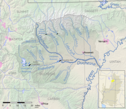
The Uinta River (historically also spelled Uintah River) is a tributary of the Duchesne River flowing through Duchesne and Uintah counties in Utah, United States.1 Originating in the Uinta Mountains, the river flows southeast for about 60 miles (97 km)2 to join the Duchesne near Randlett. The Uinta is an important source of water for local irrigation. Its tributaries include the Whiterocks River, which joins it near Whiterocks, and the Dry Gulch Creek near Fort Duchesne.
References
References
- U.S. Geological Survey Geographic Names Information System: Uinta River
- U.S. Geological Survey. National Hydrography Dataset high-resolution flowline data. The National Map, accessed 2016-05-13
External links
External links
Media related to Uinta River at Wikimedia Commons
40°13′00″N 109°47′11″W / 40.2166°N 109.7865°W / 40.2166; -109.7865