| Tym | |
|---|---|
 | |
 | |
| Native name | Тым (Russian) |
| Location | |
| Country | Russia |
| Physical characteristics | |
| Mouth | Ob |
• coordinates | 59°25′55″N 80°01′40″E / 59.4319°N 80.0278°E / 59.4319; 80.0278 |
| Length | 950 km (590 mi) |
Basin size | 32,300 km2 (12,500 sq mi) |
| Basin features | |
| Progression | Ob→ Kara Sea |
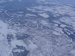
The Tym (Russian: Тым) is a river in Krasnoyarsk Krai and Tomsk Oblast in Russia, right tributary of the Ob. The length of the river is 950 kilometres (590 mi), and it drains a basin of 32,300 square kilometres (12,500 mi2).1 The Tym freezes up in October to early November and stays icebound until late April to May. It is navigable within 560 kilometres (350 mi) of its estuary.