Trory
| |
|---|---|
Trory Location within Northern Ireland | |
| Population | 90 (2001 Census) |
| District | |
| County | |
| Country | Northern Ireland |
| Sovereign state | United Kingdom |
| Postcode district | BT |
| Dialling code | 028 |
| UK Parliament | |
| NI Assembly | |
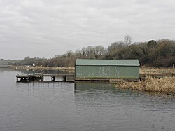
Trory (from Irish Treabhraigh, meaning 'place of tillage') is a townland (of 335 acres), small village and civil parish in County Fermanagh, Northern Ireland, 3 miles (5 km) north of Enniskillen.1 The townland is situated in the historic barony of Tirkennedy, and the civil parish covers areas of the barony of Tirkennedy, as well as the barony of Lurg.23 In the 2001 Census it had (with Ballycassidy and Laragh) a population of 315 people.4 It lies within the Fermanagh and Omagh District Council area.
St Michael's Church of Ireland Parish Church in Trory is a listed building.
Transport
The ferry to Devenish Island leaves from Trory point about 1.5 miles out of Enniskillen.5
Civil parish of Trory
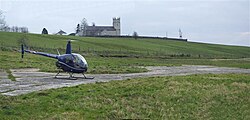


The civil parish includes the small village of Ballycassidy.
Townlands
The civil parish includes the following townlands:3
B
C
Car Island, Cloghbally, Concrick
D
Derryargon, Derrygore, Derryinch, Drumcoo, Drumgarrow, Drummackilowney
F
G
H
I
K
L
M
Mossfield (also known as Urbal)
O
P
Paris Island Big, Paris Island Little
R
S
T
Thornhill Glebe, Trasna Island, Trory, Tully, Tullyavy, Tullylone
U
Urbal (also known as Mossfield)
W
See also
See also
References
References
- Sanderson, Ernest (1976). Discover Northern Ireland. Belfast: Northern Ireland Tourist Board. p. 141. ISBN 0 9500222 7 6.
- "Trory". Place Names NI. Retrieved 19 April 2015.
- "Trory". IreAtlas Townlands Database. Retrieved 19 April 2015.
- NI Neighbourhood Information System
- Enniskillen.com Archived 2008-12-24 at the Wayback Machine