| Trigno | |
|---|---|
 | |
 | |
| Location | |
| Country | Italy |
| Physical characteristics | |
| Source | |
| • location | Monte Capraro |
| • elevation | 1,150 m (3,770 ft) |
| Mouth | Adriatic Sea |
• coordinates | 42°03′47″N 14°47′48″E / 42.0630°N 14.7968°E / 42.0630; 14.7968 |
• elevation | 0 m (0 ft) |
| Length | 85 km (53 mi) |
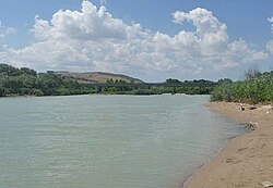
The Trigno (Latin: Trinius) is an 85-kilometre (53 mi) Italian river. It originates in the Apennine Mountains, in the province of Isernia and flows into the Adriatic Sea near Vasto. It also forms the border between the regions Abruzzo and Molise.1
On 2 April 2026, following bad weather conditions, one of the bridges over the Trigno collapsed. One person who was at the bridge at the time went missing.2
References
References
- Di Marco, Michele Antonio (2020). Mundunur: A Mountain Village Under the Spell of South Italy. Via Media Publishing. p. 29. ISBN 9781893765580. Retrieved January 12, 2025.
- Musiu, Valeriano (7 April 2026). "Si risveglia frana storica in Molise, chiuse A14 e linea ferroviaria". Il Sole 24 Ore (in Italian).