Tinjan
Antignana | |
|---|---|
Municipality | |
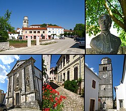 | |
 Flag | |
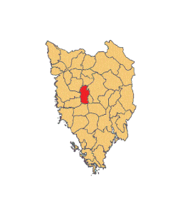 Location of Tinjan in Istria | |
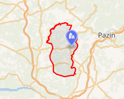 Interactive map of Tinjan | |
Tinjan | |
| Coordinates: 45°13′02″N 13°50′20″E / 45.21722°N 13.83889°E / 45.21722; 13.83889 | |
| Country |  Croatia Croatia |
| County |  Istria County Istria County |
| Area | |
• Municipality | 20.4 sq mi (52.8 km2) |
| • Urban | 4.2 sq mi (10.8 km2) |
| Population (2021)2 | |
• Municipality | 1,729 |
| • Density | 84.8/sq mi (32.7/km2) |
| • Urban | 433 |
| • Urban density | 104/sq mi (40.1/km2) |
| Time zone | UTC+1 (CET) |
| • Summer (DST) | UTC+2 (CEST) |
| Postal code3 | 52000 Pazin |
| Area code | 52 |
| Website | tinjan |
Tinjan (Italian: Antignana) is a village and municipality in Istria, west Croatia.
Tinjan is located is 50 km north of Pula and 10 km southwest of Pazin, in the Draga valley. The Coat of Arms of Tinjan is azure on a base vert a tower argent behind walls of the same. This is based on the historical pattern.
Demographics
According to the 2021 census, its population was 1,729 with 433 living in the village of Tinjan itself.2
The municipality consists of the following settlements:2
Tinjan: Population trends 1857–2021
| population | 2664 | 2755 | 2746 | 2998 | 3132 | 3555 | 3771 | 3636 | 3389 | 3259 | 2591 | 2243 | 1999 | 1820 | 1770 | 1684 | 1729 |
| 1857 | 1869 | 1880 | 1890 | 1900 | 1910 | 1921 | 1931 | 1948 | 1953 | 1961 | 1971 | 1981 | 1991 | 2001 | 2011 | 2021 |
References
References
- Register of spatial units of the State Geodetic Administration of the Republic of Croatia. Wikidata Q119585703.
- "Population by Age and Sex, by Settlements" (xlsx). Census of Population, Households and Dwellings in 2021. Zagreb: Croatian Bureau of Statistics. 2022.
- List of Croatian settlements and delivery post offices. Wikidata Q125763583.