Temploux
Timplou (Walloon) | |
|---|---|
 Saint-Hilaire Church in the centre of Temploux | |
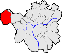 Location of Temploux in Namur | |
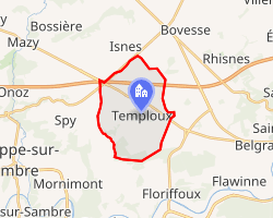 Interactive map of Temploux | |
Temploux Temploux | |
| Coordinates: 50°29′00″N 4°45′00″E / 50.48333°N 4.75000°E / 50.48333; 4.75000 | |
| Country |  Belgium Belgium |
| Community | French Community |
| Region | Wallonia |
| Province | Namur |
| Arrondissement | Namur |
| Municipality | Namur |
| Area | |
• Total | 11.53 km2 (4.45 sq mi) |
| Population (2020-01-01) | |
• Total | 2,136 |
| • Density | 185.3/km2 (479.8/sq mi) |
| Postal codes | 5020 |
| Area codes | 081 |
| Website | temploux.be |
Temploux (French pronunciation: [tɑ̃plu]; Walloon: Timplou) is a sub-municipality of the city of Namur located in the province of Namur, Wallonia, Belgium. It was a separate municipality until 1977. On 1 January 1977, it was merged into Namur.1
It lies in the Condroz 7 kilometres (4.3 mi) west of the city centre.
External links
External links
- "Website of Temploux" (in French). Archived from the original on 25 November 2005. Retrieved 30 January 2014.
- "Website of the aerodrome of Namur" (in French). Archived from the original on 2005-01-11. Retrieved 30 January 2014.