Tejutepeque | |
|---|---|
District | |
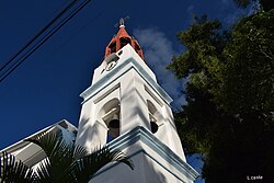 | |
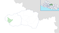 Location of Tejutepeque in Cabañas Department | |
Tejutepeque Location in El Salvador | |
| Coordinates: 13°51′N 88°54′W / 13.850°N 88.900°W / 13.850; -88.900 | |
| Country |  El Salvador El Salvador |
| Department |  Cabañas Cabañas |
| Municipality | Cabañas Oeste |
| Elevation | 2,277 ft (694 m) |
| Population (2024)1 | |
• District | 7,189 |
| • Rank | 164th in El Salvador |
| • Rural | 7,189 |
| • Summer (DST) | -06:00 GMT |
Tejutepeque is a district in the Cabañas Department of El Salvador.2 It has a population of 20,000.
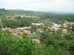
History
Tejutepeque is thought to be one of 59 surviving settlements that already existed in 1524 when the Spanish first arrived in what is now El Salvador. It became a municipality in 1847 and was incorporated into Cabañas in 1873, having formerly been part of the Cuscatlán department. It officially became a town in 1879 and a city in 1996.2
The name of the municipality is composed of the Nahuat words “tejut” or “texut” meaning “embers”, and “tepec” meaning “hill or mountain”: “Ember Mountain” 2
Traditions
Each October, the municipality has festivities in honor of its patron saint, Saint Raphael the Archangel. It also holds a special procession on Palm Sunday.2
References
References
- "City Population: Check for Humans". City Population. Retrieved 2026-07-04.
- Herrera, Alejandro (11 October 2023). "Tejutepeque, Cerro de las Brasas". Guanacos (in Spanish). Retrieved 27 April 2024.