Teichwolframsdorf | |
|---|---|
 A view of Teichwolframsdorf | |
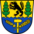 Coat of arms | |
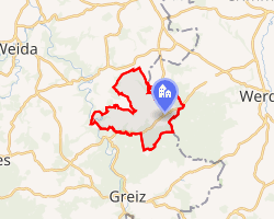 Location of Teichwolframsdorf | |
Teichwolframsdorf Teichwolframsdorf | |
| Coordinates: 50°43′14″N 12°14′49″E / 50.72056°N 12.24694°E / 50.72056; 12.24694 | |
| Country | Germany |
| State | Thuringia |
| District | Greiz |
| Municipality | Mohlsdorf-Teichwolframsdorf |
| Subdivisions | 5 |
| Area | |
• Total | 26.15 km2 (10.10 sq mi) |
| Elevation | 320 m (1,050 ft) |
| Population (2010-12-31) | |
• Total | 2,481 |
| • Density | 94.88/km2 (245.7/sq mi) |
| Time zone | UTC+01:00 (CET) |
| • Summer (DST) | UTC+02:00 (CEST) |
| Postal codes | 07989 |
| Dialling codes | 036624 |
| Vehicle registration | GRZ |
| Website | www.teichwolframsdorf.de |
Teichwolframsdorf is a village and a former municipality in the district of Greiz, in Thuringia, Germany. Since January 1, 2012, it is part of the municipality Mohlsdorf-Teichwolframsdorf.
History
Within the German Empire (1871-1918), Teichwolframsdorf was part of the Grand Duchy of Saxe-Weimar-Eisenach.
References
References