Te Puna | |
|---|---|
Town | |
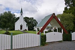 St Joseph's Church | |
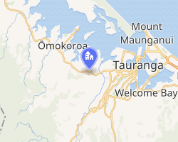 Interactive map of Te Puna | |
| Coordinates: 37°41′45″S 176°04′22″E / 37.695823°S 176.072806°E / -37.695823; 176.072806 | |
| Country | New Zealand |
| Region | Bay of Plenty |
| Territorial authority | Western Bay of Plenty District |
| Ward | Kaimai |
| Electorates | |
| Government | |
| • Territorial authority | Western Bay of Plenty District Council |
| • Regional council | Bay of Plenty Regional Council |
| • Mayor of Western Bay of Plenty | James Denyer1 |
| • Bay of Plenty MP | Tom Rutherford2 |
| • Waiariki MP | Rawiri Waititi3 |
| Area | |
• Total | 24.71 km2 (9.54 sq mi) |
| Population (June 2025)5 | |
• Total | 3,090 |
| • Density | 125/km2 (324/sq mi) |
Te Puna is a rural community near Tauranga in the Bay of Plenty region of New Zealand's North Island. It is located on State Highway 2, north of Bethlehem and south of Katikati.
The local Te Puna Quarry has been redeveloped by volunteers into a park.6
Former National Party leader Todd Muller was raised in Te Puna in the 1970s, where his parents started a kiwifruit orchard.7 He attended Te Puna Primary School.8 He entered parliament at the 2014 general election as the MP for Bay of Plenty, and was National Party leader and the Leader of the Opposition from 22 May to 14 July 2020.9
Demographics
Te Puna statistical area, which includes Motuhoa Island, Plummers Point and Te Puna West, covers 24.71 km2 (9.54 sq mi)4 and had an estimated population of 3,090 as of June 2025,5 with a population density of 125 people per km2.
| Year | Pop. | ±% p.a. |
|---|---|---|
| 2006 | 2,004 | — |
| 2013 | 2,583 | +3.69% |
| 2018 | 2,931 | +2.56% |
| 2023 | 3,024 | +0.63% |
| The 2006 population is for a smaller area of 18.16 km2, excluding Plummers Point. Source: 1011 | ||
Te Puna had a population of 3,024 in the 2023 New Zealand census, an increase of 93 people (3.2%) since the 2018 census, and an increase of 441 people (17.1%) since the 2013 census. There were 1,521 males, 1,497 females, and 6 people of other genders in 1,059 dwellings.12 1.9% of people identified as LGBTIQ+. The median age was 48.1 years (compared with 38.1 years nationally). There were 525 people (17.4%) aged under 15 years, 444 (14.7%) aged 15 to 29, 1,431 (47.3%) aged 30 to 64, and 624 (20.6%) aged 65 or older.10
People could identify as more than one ethnicity. The results were 76.7% European (Pākehā); 30.3% Māori; 3.7% Pasifika; 2.9% Asian; 0.6% Middle Eastern, Latin American and African New Zealanders (MELAA); and 1.8% other, which includes people giving their ethnicity as "New Zealander". English was spoken by 97.5%, Māori by 12.1%, Samoan by 0.1%, and other languages by 5.9%. No language could be spoken by 1.4% (e.g. too young to talk). New Zealand Sign Language was known by 0.5%. The percentage of people born overseas was 16.1, compared with 28.8% nationally.10
Religious affiliations were 36.9% Christian, 0.5% Hindu, 4.0% Māori religious beliefs, 0.3% Buddhist, 0.5% New Age, 0.1% Jewish, and 1.1% other religions. People who answered that they had no religion were 49.2%, and 7.5% of people did not answer the census question.10
Of those at least 15 years old, 579 (23.2%) people had a bachelor's or higher degree, 1,425 (57.0%) had a post-high school certificate or diploma, and 492 (19.7%) people exclusively held high school qualifications. The median income was $42,500, compared with $41,500 nationally. 369 people (14.8%) earned over $100,000 compared to 12.1% nationally. The employment status of those at least 15 was 1,206 (48.3%) full-time, 453 (18.1%) part-time, and 45 (1.8%) unemployed.10
Marae
Te Puna has four marae belonging to the Ngāti Ranginui hapū of Pirirākau:1314
- Paparoa Marae and Werahiko meeting house
- Poutūterangi Marae and Takurua meeting house
- Tutereinga Marae and meeting house
- Tawhitinui and Maka meeting house
Education
Te Puna School is a co-educational state primary school for Year 1 to 8 students,1516 with a roll of 238 as of March 2026.17 The school opened in 1896 and moved to its current site in 1904.18
Railway stations
Te Puna railway station
Te Puna had a flag station on the East Coast Main Trunk (ECMT) from 16 October 1913 to 21 December 1959,19 though a special train ran on 29 February 192820 and goods were carried from 5 March. New Zealand Railways (NZR) took over from the Public Works Department (PWD) on 18 June 1928.21 The station had a shelter shed, cart approach, a 30 ft (9.1 m) by 20 ft (6.1 m) goods shed, cattle and sheep yards, a loading bank and a passing loop for 48 wagons,21 which remains.22

The 6 mi (9.7 km) Tauranga-Te Puna section was built by PWD.23 The 8 mi (13 km) to Te Maunga was included in the 1911 Railways Authorisation Act.24 By 1913 it could be used by jiggers,25 was used to carry sleepers in 1926,26 but saw little use until formally opened with the whole ECMT on 2 September 1928. At a public meeting in 1924, opinion was divided on the location of the station.27
To the north, the first sod was turned for the 18.5 mi (29.8 km) Katikati-Te Puna section by the Minister of Works, Gordon Coates, using a Ruston steam shovel, at Te Puna on 8 November 1924.28 The section was built by Sir W. G. Armstrong, Whitworth & Co for about £500,000. Due to difficulties in establishing firm foundations for the line and its bridges, it was the last section of the Auckland-Tāneatua line to be completed.29 It was unusual at the time for contracts to be given to private companies, rather than to PWD, or worker cooperatives.30 The contractors built a wharf and stacking yard at Mount Maunganui, and landing-stages at several estuaries along the Harbour. They built 100 x 2-man, 13 x 4-man, 66 x 6-man huts, 46 married quarters, 3 cookhouses, 4 bathhouses, 2 recreation-rooms, quarters for field engineers and had two steam-locomotives, six steam-navvies, six petrol-locomotives, two steam pile-drivers, concrete-mixers, launches, punts, motor-lorries and ballast-trucks. Earthworks amounted to 1,229,000 yd3 (940,000 m3).31
Bridge 62 over the Wairoa River is 257.46m long.22
| Preceding station | Historical railways | Following station | ||
|---|---|---|---|---|
| Ōmokoroa Line open, station closed 5.42 km (3.37 mi) Towards Hamilton32 |
East Coast Main Trunk New Zealand Railways Department |
Otūmoetai Line open, station closed 5.61 km (3.49 mi) Towards Tāneatua | ||
Borell Road railway station
Borell Road replaced Te Puna as a stopping place for railcars from 21 December 1959 to 11 September 1967.19 It closed for goods on 8 April 1969.21 It was 1.28 km (0.80 mi) from Te Puna and 4.14 km (2.57 mi) from Ōmokoroa.33
References
References
- "2025 Triennial Elections Declaration of Result" (PDF). Electionz. Retrieved 22 October 2025.
- "Bay of Plenty - Official Result". Electoral Commission. 6 November 2023. Retrieved 29 May 2025.
- "Waiariki – Official Result". Electoral Commission. Retrieved 12 May 2025.
- "Stats NZ Geographic Data Service". Statistical Area 2 2023 (generalised). Retrieved 29 May 2025.
- "Subnational population estimates - Aotearoa Data Explorer". Statistics New Zealand. Retrieved 29 October 2025.
- "Te Puna Quarry Park Open all day, every day. Free admission". quarrypark.org.nz. Te Puna Quarry Park.
- Braae, Alex (15 September 2019). "The increasingly uncompromising Todd Muller". The Spinoff. Retrieved 28 May 2020.
- Braae, Alex. "Here's what you need to know about new National leader Todd Muller". The Spinoff.
- Ensor, Jamie (14 July 2020). "Live updates: Todd Muller resigns as National Party leader". Newshub. Archived from the original on 13 July 2020. Retrieved 14 July 2020.
- "Totals by topic for individuals, (RC, TALB, UR, SA3, SA2, Ward, Health), 2013, 2018, and 2023 Censuses". Stats NZ – Tatauranga Aotearoa – Aotearoa Data Explorer. Te Puna (191201). Retrieved 3 October 2024.
- "Statistical area 1 dataset for 2018 Census". Statistics New Zealand. March 2020. Te Puna (191200). 2018 Census place summary: Te Puna
- "Totals by topic for dwellings, (RC, TALB, UR, SA3, SA2, Ward, Health), 2013, 2018, and 2023 Censuses". Stats NZ – Tatauranga Aotearoa – Aotearoa Data Explorer. Retrieved 3 October 2024.
- "Te Kāhui Māngai directory". tkm.govt.nz. Te Puni Kōkiri.
- "Māori Maps". maorimaps.com. Te Potiki National Trust.
- "Te Puna School Official School Website". tepuna.school.nz.
- "Te Puna School Ministry of Education School Profile". educationcounts.govt.nz. Ministry of Education.
- "Te Puna School Education Review Office Report". ero.govt.nz. Education Review Office.
- "Parents Information Booklet". Te Puna School. Retrieved 29 May 2025.
- Scoble, Juliet (2010). "Names & Opening & Closing Dates of Railway Stations" (PDF). Rail Heritage Trust of New Zealand. Archived from the original (PDF) on 24 July 2020. Retrieved 23 April 2021.
- "Bay of Plenty Times". 28 February 1928.
- Scoble, Juliet. "Station Archive". Rail Heritage Trust of New Zealand.
- "KiwiRail Network Map". arcgis.com. Retrieved 21 April 2026.
- "East coast railway. Bay of Plenty Times". 31 July 1923.
- "Railways Authorisation Bill. Gisborne Times". 19 October 1911.
- "Ministerial tour. New Zealand Herald". 10 January 1913.
- "Local and general. Te Puke Times". 16 February 1926.
- "Site for Te Puna railway station. Bay of Plenty Times". 27 March 1924.
- "First Sod Turned For Katikati-Te Puna Section of North Island East Coast Railway". kura.aucklandlibraries.govt.nz. 13 November 1924. Retrieved 22 April 2026.
- "East coast railway. Poverty Bay Herald". 28 March 1928.
- "Public Works Statement by the Hon. J. G. Coates, Minister of Public Works". 1923.
- "Public Works Statement by the Hon. J. G. Coates, Minister of Public Works". 1925.
- Yonge, John Roger (1993). New Zealand Railway and Tramway Atlas. Quail Map Company. ISBN 9780900609923.
- New Zealand Railway and Tramway Atlas (First ed.). Quail Map Co. 1965. pp. 3 & 4.
External links
External links
Photos -