Tashanta
Ташанта | |
|---|---|
Village | |
 | |
Tashanta Tashanta | |
| Coordinates: 49°42′N 89°11′E / 49.700°N 89.183°E / 49.700; 89.1831 | |
| Country | Russia |
| Region | Altai Republic |
| District | Kosh-Agachsky District |
| Time zone | UTC+7:00 |
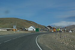
Tashanta (Russian: Ташанта; Altay: Тожоҥты, Tojoñtı) is a rural locality (a selo) and the administrative centre of Tashantinskoye Rural Settlement of Kosh-Agachsky District, the Altai Republic, Russia. The population was 547 as of 2016.2 There are 13 streets.
Geography
Tashanta is located on the bank of the river Tashantinki near the Russian border with Mongolia, 51 km southeast of Kosh-Agach (the district's administrative centre) by road. Zhana-Aul is the nearest rural locality.3
References
References
- Карта села Ташанта в республике Алтай
- "Оценка численности постоянного населения Республики Алтай по населённым пунктам за 2012-2016 годы". Archived from the original on 2019-03-04. Retrieved 2018-09-22.
- Расстояние от Ташанты до Коша-Агача