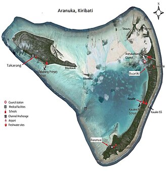
 Map of Aranuka | |
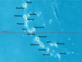 | |
| Geography | |
|---|---|
| Location | Pacific Ocean |
| Coordinates | 0°09′N 173°35′E / 0.150°N 173.583°E / 0.150; 173.583 (Aranuka) |
| Archipelago | Gilbert Islands |
| Area | 13.228 km2 (5.107 sq mi) |
| Highest elevation | 3 m (10 ft) |
| Administration | |
| Capital | Buariki |
| Demographics | |
| Population | 1,057 (2010 Census) |
| Pop. density | 79.9/km2 (206.9/sq mi) |
| Ethnic groups | I-Kiribati 99.6% |
Takaeang is the second largest island in the Aranuka atoll of Kiribati. It helps form the triangular shape of the atoll by forming the top corner of the triangle.1 It is connected to the larger island, Buariki, by a sandbank.1
The village is also called Takaeang.
References
References
- "10. Aranuka" (PDF). Office of Te Beretitent - Republic of Kiribati Island Report Series. 2012. Archived from the original (PDF) on 13 September 2013. Retrieved 28 April 2015.