Taingy | |
|---|---|
Part of Les Hauts de Forterre | |
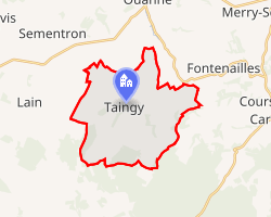 Location of Taingy | |
Taingy Taingy | |
| Coordinates: 47°37′01″N 3°24′16″E / 47.6169°N 3.4044°E / 47.6169; 3.4044 | |
| Country | France |
| Region | Bourgogne-Franche-Comté |
| Department | Yonne |
| Arrondissement | Auxerre |
| Canton | Vincelles |
| Commune | Les Hauts de Forterre |
Area 1 | 20.81 km2 (8.03 sq mi) |
| Population (2022)1 | 246 |
| • Density | 11.8/km2 (30.6/sq mi) |
| Time zone | UTC+01:00 (CET) |
| • Summer (DST) | UTC+02:00 (CEST) |
| Postal code | 89560 |
| Elevation | 224–386 m (735–1,266 ft) |
| 1 French Land Register data, which excludes lakes, ponds, glaciers > 1 km2 (0.386 sq mi or 247 acres) and river estuaries. | |
Taingy (French pronunciation: [tɛ̃ʒi]) is a former commune in the Yonne department in Bourgogne-Franche-Comté in north-central France. On 1 January 2017, it was merged into the new commune Les Hauts de Forterre.2
References
References
- "Populations de référence 2022" [Reference populations 2022] (PDF) (in French). INSEE. December 2024.
- Arrêté préfectoral 16 August 2016 (in French)