| Sundance Range | |
|---|---|
 | |
| Highest point | |
| Listing | Ranges of the Canadian Rockies |
| Geography | |
Sundance Range Location in Alberta Show map of AlbertaSundance Range Location in Canada Show map of Canada | |
Country | Canada |
Province | Alberta |
Range coordinates | 51°02′35″N 115°34′17″W / 51.04306°N 115.57139°W / 51.04306; -115.571391 |
| Parent range | Park Ranges |
| Topo map | NTS 82O4 Banff1 |
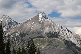
The Sundance Range is a mountain range in the Canadian Rockies, south of the town of Banff.2 It is located on the Continental Divide, which forms the boundary between British Columbia and Alberta in this region.
Mountains
This range includes the following mountains and peaks:3
| Mountain/Peak | Elevation (m/ft) | Prominence (m) | |
|---|---|---|---|
| Beersheba Peak | 3,054 | 10,020 | 885 |
| Mount Allenby | 2,995 | 9,826 | 349 |
| Mount Mercer | 2,970 | 9,740 | 295 |
| Cone Mountain | 2,909 | 9,544 | 395 |
| Sundance Peak | 2,902 | 9,521 | 388 |
| Mount Turbulent | 2,800 | 9,200 | 654 |
References
References
- "Sundance Range". Geographical Names Data Base. Natural Resources Canada. Retrieved 2021-01-28.
- "Sundance Range". Bivouac.com. Retrieved 2011-01-26.
- "Peaks of the Sundance Range". Peakbagger.com. Retrieved 2019-02-18.
Further reading
Further reading
- Williams, Richard S.; Ferrigno, Jane G. (2002). "U.S. Geological Survey Professional Paper 1386-J". U.S. Government Printing Office. p. 216. Retrieved 2023-07-09.
- Birrell, Dave (2000). 50 Roadside Panoramas in the Canadian Rockies. Rocky Mountain Books Ltd. p. 81. ISBN 9780921102656. Retrieved 2023-07-09.