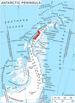
Strelcha Spur (Bulgarian: рид Стрелча, ‘Rid Strelcha’ \'rid 'strel-cha\) is the rocky, partly ice-covered spur extending 5.3 km in south-southeast to north-northwest direction and 1.4 km wide, rising to 1572 m1 in the west foothills of Bruce Plateau on Graham Coast in Graham Land, Antarctica. It has steep and partly ice-free west, north and east slopes, and surmounts Birley Glacier to the north and east, and a tributary to that glacier to the west.
The spur is named after the town of Strelcha in Southern Bulgaria.
Location
Strelcha Spur is located at 65°59′35″S 64°21′29″W / 65.99306°S 64.35806°W / -65.99306; -64.35806, which is 9.56 km northeast of Mezzo Buttress, 6 km east of Vardun Point, 10 km south of Mount Dewey, and 38.8 km west of Kyulevcha Nunatak on Oscar II Coast.
Maps
- Antarctic Digital Database (ADD). Scale 1:250000 topographic map of Antarctica. Scientific Committee on Antarctic Research (SCAR). Since 1993, regularly upgraded and updated.
- British Antarctic Territory. Scale 1:200000 topographic map. DOS 610 Series, Sheet W 65 64. Directorate of Overseas Surveys, Tolworth, UK, 1971.
Notes
Notes
- Reference Elevation Model of Antarctica. Polar Geospatial Center. University of Minnesota, 2019
References
References
- Bulgarian Antarctic Gazetteer. Antarctic Place-names Commission. (details in Bulgarian, basic data in English)
- Strelcha Spur. SCAR Composite Antarctic Gazetteer
External links
External links
- Strelcha Spur. Adjusted Copernix satellite image
This article includes information from the Antarctic Place-names Commission of Bulgaria which is used with permission.