Straumsnes | |
|---|---|
Village | |
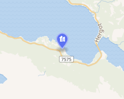 Interactive map of Straumsnes | |
Straumsnes Straumsnes | |
| Coordinates: 68°26′28″N 17°39′16″E / 68.4411°N 17.6545°E / 68.4411; 17.6545 | |
| Country | Norway |
| Region | Northern Norway |
| County | Nordland |
| District | Ofoten |
| Municipality | Narvik Municipality |
| Elevation | 41 m (135 ft) |
| Time zone | UTC+01:00 (CET) |
| • Summer (DST) | UTC+02:00 (CEST) |
| Post Code | 8517 Narvik |
Straumsnes2 (or Strømsnes) is a village in Narvik Municipality in Nordland county, Norway. The village is located along the Rombaken fjord between the town of Narvik and the village of Hergot. The village has a train station on the Ofotbanen railway line, between Narvik Station and Rombak Station. The village sits along the European route E06 highway, just southeast of the Rombak Bridge.
References
References
- "Strømsnes, Narvik (Nordland)". yr.no. Retrieved 2019-01-08.
- "Informasjon om stadnamn". Norgeskart (in Norwegian). Kartverket. Retrieved 2024-08-25.