Stepenitztal | |
|---|---|
Location of Stepenitztal
within Nordwestmecklenburg district
| |
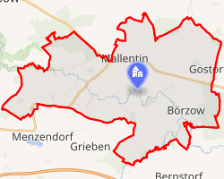 Location of Stepenitztal | |
Stepenitztal Stepenitztal | |
| Coordinates: 53°52′N 11°05′E / 53.867°N 11.083°E / 53.867; 11.083 | |
| Country | Germany |
| State | Mecklenburg-Vorpommern |
| District | Nordwestmecklenburg |
| Municipal assoc. | Grevesmühlen-Land |
| Area | |
• Total | 45.03 km2 (17.39 sq mi) |
| Elevation | 29 m (95 ft) |
| Population (2024-12-31)1 | |
• Total | 1,728 |
| • Density | 38.37/km2 (99.39/sq mi) |
| Time zone | UTC+01:00 (CET) |
| • Summer (DST) | UTC+02:00 (CEST) |
| Postal codes | 23936, 23923 |
| Dialling codes | 038824, 03881 |
| Vehicle registration | NWM |
| Website | www.grevesmuehlen.de |
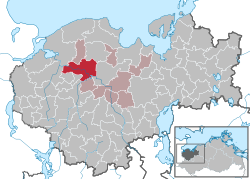
Stepenitztal is a municipality in the Nordwestmecklenburg district, in Mecklenburg-Vorpommern, Germany. It takes its name from the river Stepenitz. It was formed on 25 May 2014 by the merger of the former municipalities Börzow, Mallentin and Papenhusen.
References
References