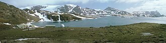
 Signy Island base and panorama | |
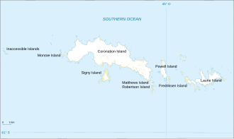 Map of the South Orkney Islands | |
| Geography | |
|---|---|
| Coordinates | 60°36′S 45°30′W / 60.600°S 45.500°W / -60.600; -45.500 |
| Area | 620 km2 (240 sq mi) |
| Highest elevation | 4,153 ft (1265.8 m) |
| Administration | |
Administered under the Antarctic Treaty System | |
| Demographics | |
| Population | approx. 53-55 (summer) 14 (winter) |
Spindrift Col is a mountain pass running through north-central Signy Island in the South Orkney Islands. It is located 0.5 nautical miles (0.9 km) southeast of Spindrift Rocks, its namesake.
It was named by the United Kingdom Antarctic Place-Names Committee (UK-APC) in 1974, after the sea spray that occurs in their surroundings with strong westerly winds.
References
References
- "Antarctica Detail". USGS. Archived from the original on 2 June 2021. Retrieved 10 April 2025.
- "Spindrift Col". geographic.org. Retrieved 10 April 2025.
This article incorporates public domain material from "Spindrift Col". Geographic Names Information System. United States Geological Survey.