| Spiller Range | |
|---|---|
 | |
| Highest point | |
| Elevation | 665 m (2,182 ft) |
| Dimensions | |
| Area | 51 km2 (20 mi2) |
| Geography | |
Country | Canada |
Province | British Columbia |
Range coordinates | 54°02′N 130°21′W / 54.033°N 130.350°W / 54.033; -130.350 |
| Parent range | Kitimat Ranges |
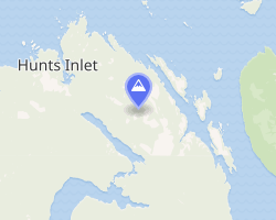
The Spiller Range is a small subrange of the Kitimat Ranges, located on the northeastern end of Porcher Island, British Columbia, Canada.
References
References
- "Spiller Range". BC Geographical Names. Government of British Columbia – B.C. Geographical Names Office (BCGNO).
- Spiller Range in the Canadian Mountain Encyclopedia