| Site of Special Scientific Interest | |
 | |
 Location of Southerham Works Pit. | |
| Area of search | East Sussex |
|---|---|
| Grid reference | TQ 426 0961 |
| Interest | Geological |
| Area | 1.0 hectare (2.5 acres)1 |
| Notification date | 19961 |
| Location map | Magic Map |
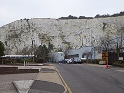
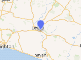
Southerham Works Pit is a 1-hectare (2.5-acre) geological Site of Special Scientific Interest in Lewes in East Sussex.12 It is a Geological Conservation Review site.34
This site exposes layers of the Chalk Group dating to the Upper Cretaceous between 90 and 87 million years ago. It is a key site for understanding the lithostratigraphy of the period and the environments of its chalk sea as well as the evolution and taxonomy of Upper Cretaceous fish.5
There is access to the southern end of the site from Southerham Lane.
References
References
- "Designated Sites View: Southerham Works Pit". Sites of Special Scientific Interest. Natural England. Retrieved 9 January 2019.
- "Map of Southerham Works Pit". Sites of Special Scientific Interest. Natural England. Retrieved 9 January 2019.
- "Southerham (Lime Kiln Quarries) (Mesozoic - Tertiary Fish/Amphibia)". Geological Conservation Review. Joint Nature Conservation Committee. Retrieved 8 January 2019.
- "Southerham Pit (Cenomanian, Turonian, Senonian, Maastrichtian)". Geological Conservation Review. Joint Nature Conservation Committee. Retrieved 8 January 2019.
- "Southerham Works Pit citation" (PDF). Sites of Special Scientific Interest. Natural England. Retrieved 9 January 2019.