| Solnan | |
|---|---|
 | |
 | |
| Location | |
| Country | France |
| Physical characteristics | |
| Source | |
| • location | Verjon |
| • coordinates | 46°20′33″N 05°21′34″E / 46.34250°N 5.35944°E / 46.34250; 5.35944 |
| • elevation | 235 m (771 ft) |
| Mouth | |
• location | Seille |
• coordinates | 46°37′45″N 05°13′05″E / 46.62917°N 5.21806°E / 46.62917; 5.21806 |
• elevation | 177 m (581 ft) |
| Length | 61.6 km (38.3 mi) |
Basin size | 680 km2 (260 sq mi) |
| Discharge | |
| • average | 13 m3/s (460 cu ft/s) |
| Basin features | |
| Progression | Rhône→ Mediterranean Sea |
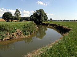
The Solnan (French pronunciation: [sɔlnɑ̃]) is a 61.6-kilometre (38.3 mi) long river in the Ain and Saône-et-Loire departments in eastern France.1 Its source is at Verjon, in the Jura Mountains. It flows generally north-northwest. It is a left tributary of the Seille, into which it flows at Louhans.
Its main tributaries are the Sevron and the Vallière.
Departments and communes along its course
This list is ordered from source to mouth:
- Ain: Verjon, Villemotier, Bény, Salavre, Coligny, Pirajoux, Domsure, Beaupont,
- Saône-et-Loire: Condal, Dommartin-lès-Cuiseaux, Varennes-Saint-Sauveur, Frontenaud, Sainte-Croix, Bruailles, La Chapelle-Naude, Louhans,