| Sofia River | |
|---|---|
 | |
 | |
| Physical characteristics | |
| Source | Tsaratanana Massif |
| • location | Sofia, Madagascar |
| • elevation | 1,784 m (5,853 ft) |
| Mouth | |
• location | near Port Bergé, Sofia Indian Ocean |
• elevation | 0 m |
| Length | 328 km (204 mi) |
Basin size | 29,267 km2 (11,300 sq mi)1 |
| Discharge | |
| • location | Sofia Delta |
| • average | (Period: 1971–2000)1,061.9 m3/s (37,500 cu ft/s)1 |
| Basin features | |
| River system | Sofia River |

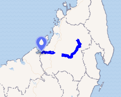
The Sofia is a river of northwestern Madagascar. It flows through the Sofia Region. The source is at the Tsaratanana Massif at an altitude of 1784 metres.2 It has a length of 328 kilometres (204 mi).3
Its mouth is in the Indian Ocean in the Boriziny-Vaovao District (Port-Bergé).
References
References
- "Madagascar".
- Hughes, Ralph H.; Hughes, Jane S. (1992). Iucn Directory of African Wetlands. IUCN. p. 801. ISBN 978-2-88032-949-5. Retrieved 8 January 2013.
- Fleuves & Rivieres de Madagascar
15°25′48″S 47°10′48″E / 15.43000°S 47.18000°E / -15.43000; 47.18000