| Slate Range | |
|---|---|
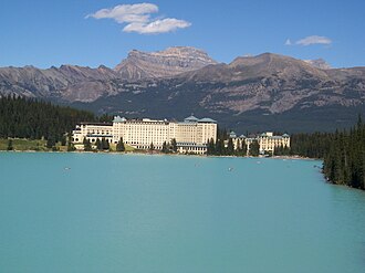 Mt. Richardson seen from Lake Louise | |
| Highest point | |
| Peak | Mount Richardson |
| Elevation | 3,086 m (10,125 ft)12 |
| Prominence | 922 m (3,025 ft)3 |
| Listing | Mountains of Alberta |
| Coordinates | 51°29′45″N 116°07′21″W / 51.49583°N 116.12250°W / 51.49583; -116.122504 |
| Dimensions | |
| Length | 26 km (16 mi) W-E5 |
| Width | 13 km (8.1 mi) N-S5 |
| Geography | |
Slate Range Location in Alberta | |
Country | Canada |
Province | Alberta |
Range coordinates | 51°29′46″N 116°07′20″W / 51.49611°N 116.12222°W / 51.49611; -116.122226 |
| Parent range | Canadian Rockies |
| Topo map | NTS 82N8 Lake Louise6 |
The Slate Range is a mountain range of the Canadian Rockies, located in Banff National Park, Canada. The range is named after slate, the primary composition of the mountains in the area.7
The Lake Louise Ski Resort is on the southern slopes of this range.
Peaks
This range includes the following mountains and peaks:
References
References
- Kane, Alan (1999). "Mount Richardson". Scrambles in the Canadian Rockies. Calgary: Rocky Mountain Books. p. 250. ISBN 0-921102-67-4.
- "Topographic map of Mount Richardson". opentopomap.org. Retrieved 2023-07-18.
- "Mount Richardson". Bivouac.com. Retrieved 2023-07-18.
- "Mount Richardson". Geographical Names Data Base. Natural Resources Canada. Retrieved 2023-07-18.
- "Slate Range". Peakbagger.com. Retrieved 2019-06-11.
- "Slate Range". Geographical Names Data Base. Natural Resources Canada. Retrieved 2019-06-11.
- "Slate Range". cdnrockiesdatabases.ca. Retrieved 2019-06-11.