| Simiganj | |
|---|---|
 | |
| Location | |
| Country | Tajikistan |
| Physical characteristics | |
| Source | Gissar Range |
| • coordinates | 38°47′02″N 69°00′16″E / 38.7839°N 69.0044°E / 38.7839; 69.0044 |
| Mouth | Kofarnihon |
• coordinates | 38°34′07″N 69°01′07″E / 38.56861°N 69.01861°E / 38.56861; 69.01861 |
| Length | 27 km (17 mi) |
| Basin features | |
| Progression | Amu Darya→ Aral Sea |
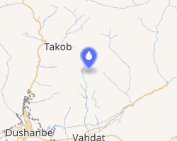
The Simiganj (Tajik: Симиганҷ, Russian: Симиганч Simiganch) is a short, 27 km, river in western Tajikistan, central Asia.
It rises from an elevation of about 3000 meters on the southwestern slopes of a mountain in the Gissar Range, flows past the town of Simiganj and enters the Kofarnihon River at the city of Vahdat.12
Notes
Notes
- Topographic Map, Dushanbe, USSR, Joint Operations Graphic, NJ 42-6, 1:250,000, United States Defense Mapping Agency, October 1977
- Topographic Map, Ordzhonikidzeabad, USSR; Afghanistan, Western Siberia, Series N502, NJ 42-7, 1:250,000, United States Army Map Service, January 1956