Senath | |
|---|---|
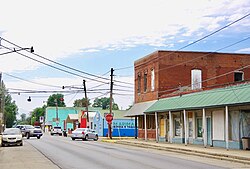 Commercial Street (State Highway P) | |
| Motto: Little City With A Big Heart | |
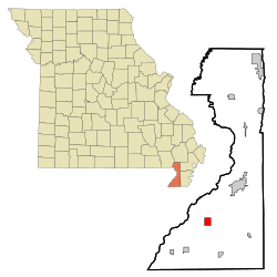 Location of Senath, Missouri | |
| Coordinates: 36°8′0″N 90°9′36″W / 36.13333°N 90.16000°W / 36.13333; -90.16000 | |
| Country | United States |
| State | Missouri |
| County | Dunklin |
| Settled | 1878 |
| Incorporated | March 10, 1882 |
| Named after | Asenath Douglass |
| Area | |
• Total | 1.92 sq mi (4.98 km2) |
| • Land | 1.92 sq mi (4.98 km2) |
| • Water | 0 sq mi (0.00 km2) |
| Elevation | 256 ft (78 m) |
| Population (2020) | |
• Total | 1,593 |
| • Density | 828/sq mi (319.7/km2) |
| Time zone | UTC-6 (Central (CST)) |
| • Summer (DST) | UTC-5 (CDT) |
| ZIP code | 63876 |
| FIPS code | 29-66638 |
| GNIS feature ID | 23965732 |
Senath /ˈsiːnəθ/ (SEE-nəth) is a city in Dunklin County, Missouri, United States. The population was 1,593 at the 2020 census.3
History
The city of Senath was first settled by A.W. Douglas, who is believed to have moved into the area in 1878.4 The city was later founded in 1882.5 It is named after an early settler, Asenath Douglass, who was commonly called Senath and in whose family her Bible-derived name Asenath was pronounced with a long "e" and with stress on the second syllable.67 A post office called Senath has been in operation since 1881.8 In 1897, the St. Louis, Kennett, & Southern Railroad was extended from Kennett south to Senath, giving the city its first rail connection.4
Geography
The city lies in the southwestern Bootheel approximately nine miles southwest of Kennett along U.S. Route 412. Senath is served by Missouri supplemental routes A, C and P.9
According to the United States Census Bureau, the city has a total area of 1.92 square miles (4.97 km2), all land.10
Demographics
| Census | Pop. | Note | %± |
|---|---|---|---|
| 1900 | 241 | — | |
| 1910 | 1,029 | 327.0% | |
| 1920 | 1,054 | 2.4% | |
| 1930 | 1,086 | 3.0% | |
| 1940 | 1,261 | 16.1% | |
| 1950 | 1,528 | 21.2% | |
| 1960 | 1,369 | −10.4% | |
| 1970 | 1,484 | 8.4% | |
| 1980 | 1,728 | 16.4% | |
| 1990 | 1,622 | −6.1% | |
| 2000 | 1,650 | 1.7% | |
| 2010 | 1,767 | 7.1% | |
| 2020 | 1,593 | −9.8% | |
| U.S. Decennial Census11 | |||
2020 census
As of the 2020 census, Senath had a population of 1,593. The median age was 38.3 years. 24.5% of residents were under the age of 18 and 15.5% of residents were 65 years of age or older. For every 100 females there were 98.6 males, and for every 100 females age 18 and over there were 96.1 males age 18 and over.1213
0.0% of residents lived in urban areas, while 100.0% lived in rural areas.14
There were 590 households in Senath, of which 33.4% had children under the age of 18 living in them. Of all households, 40.7% were married-couple households, 19.7% were households with a male householder and no spouse or partner present, and 33.2% were households with a female householder and no spouse or partner present. About 34.4% of all households were made up of individuals and 15.9% had someone living alone who was 65 years of age or older.12
There were 709 housing units, of which 16.8% were vacant. The homeowner vacancy rate was 4.1% and the rental vacancy rate was 13.3%.12
| Race | Number | Percent |
|---|---|---|
| White | 1,104 | 69.3% |
| Black or African American | 32 | 2.0% |
| American Indian and Alaska Native | 6 | 0.4% |
| Asian | 0 | 0.0% |
| Native Hawaiian and Other Pacific Islander | 0 | 0.0% |
| Some other race | 343 | 21.5% |
| Two or more races | 108 | 6.8% |
| Hispanic or Latino (of any race) | 510 | 32.0% |
2010 census
As of the census15 of 2010, there were 1,767 people, 661 households, and 433 families living in the city. The population density was 920.3 inhabitants per square mile (355.3/km2). There were 765 housing units at an average density of 398.4 per square mile (153.8/km2). The racial makeup of the city was 76.74% White, 1.08% Black or African American, 0.17% Native American, 0.11% Asian, 20.71% from other races, and 1.19% from two or more races. Hispanic or Latino of any race were 27.62% of the population.
There were 661 households, of which 37.1% had children under the age of 18 living with them, 48.4% were married couples living together, 11.8% had a female householder with no husband present, 5.3% had a male householder with no wife present, and 34.5% were non-families. 31.0% of all households were made up of individuals, and 17.1% had someone living alone who was 65 years of age or older. The average household size was 2.56 and the average family size was 3.24.
The median age in the city was 37 years. 28.5% of residents were under the age of 18; 7.2% were between the ages of 18 and 24; 23.8% were from 25 to 44; 22.9% were from 45 to 64; and 17.5% were 65 years of age or older. The gender makeup of the city was 46.3% male and 53.7% female.
2000 census
As of the census16 of 2000, there were 1,650 people, 688 households, and 427 families living in the city. The population density was 865.3 inhabitants per square mile (334.1/km2). There were 783 housing units at an average density of 410.6 per square mile (158.5/km2). The racial makeup of the city was 91.76% White, 0.55% African American, 0.36% Native American, 0.06% Asian, 6.48% from other races, and 0.79% from two or more races. Hispanic or Latino of any race were 11.58% of the population.
There were 688 households, of which 26.3% had children under the age of 18 living with them, 48.0% were married couples living together, 10.9% had a female householder with no husband present, and 37.8% were non-families. Of all households, 34.2% were made up of individuals, and 20.3% had someone living alone who was 65 years of age or older. The average household size was 2.26 and the average family size was 2.89.
Of the city's population, 22.5% were under the age of 18, 7.2% were from 18 to 24, 24.7% were from 25 to 44, 20.8% were from 45 to 64, and 24.8% were 65 years of age or older. The median age was 41 years. For every 100 females, there were 88.4 males. For every 100 females age 18 and over, there were 81.4 males.
Education
Senath-Hornersville C-8 School District, which covers the municipality,17 operates one elementary school and Senath-Hornersville Sr. High School. The middle school is located in Hornersville.18
Senath has a public library, a branch of the Dunklin County Library.19
Notable people
- Onie Wheeler (1921–1984) – bluegrass/country/rockabilly musician
References
References
- "ArcGIS REST Services Directory". United States Census Bureau. Retrieved August 28, 2022.
- U.S. Geological Survey Geographic Names Information System: Senath, Missouri
- "Senath city, Missouri". United States Census Bureau. Retrieved May 29, 2025.
- Douglas, Robert Sidney (1912). History of southeast Missouri : a narrative account of its historical progress, its people and its principal interests. Chicago: The Lewis Pub. Co.
- Eaton, David Wolfe (1916). How Missouri Counties, Towns and Streams Were Named. The State Historical Society of Missouri. pp. 166.
- "Transcription of Mary F. Smyth-Davis, 'History of Dunklin County, Mo., 1845-1895,' St. Louis: Nixon-Jones Printing Co., 1896".
- "Dunklin County Place Names, 1928–1945 (archived)". The State Historical Society of Missouri. Archived from the original on June 24, 2016. Retrieved September 29, 2016.
{{cite web}}: CS1 maint: bot: original URL status unknown (link) - "Post Offices". Jim Forte Postal History. Retrieved September 29, 2016.
- Missouri Atlas & Gazetteer, DeLorme, 1st ed., 1998, p. 70 ISBN 0899332242
- "US Gazetteer files 2010". United States Census Bureau. Archived from the original on July 2, 2012. Retrieved July 8, 2012.
- "Census of Population and Housing". Census.gov. Retrieved June 4, 2015.
- "2020 Decennial Census Demographic Profile (DP1)". United States Census Bureau. 2021. Retrieved May 1, 2026.
- "2020 Decennial Census Redistricting Data (Public Law 94-171)". United States Census Bureau. 2021. Retrieved May 1, 2026.
- "2020 Decennial Census Demographic and Housing Characteristics (DHC)". United States Census Bureau. 2023. Retrieved May 1, 2026.
- "U.S. Census website". United States Census Bureau. Retrieved July 8, 2012.
- "U.S. Census website". United States Census Bureau. Retrieved January 31, 2008.
- Geography Division. 2020 CENSUS - SCHOOL DISTRICT REFERENCE MAP: Dunklin County, MO (PDF) (Map). U.S. Census Bureau. Retrieved May 30, 2025. - Text list
- "Senath-Hornersville C-8 School District". Great Schools. Retrieved March 17, 2018.
- "Locations". Dunklin County Library. Retrieved March 17, 2018.
Further reading
Further reading
- "R-4 School Plan for Senath Area Now Has Good Building Facilities". The Daily Dunklin Democrat. Vol. 66, no. 44A. Kennett, Missouri. November 16, 1953. pp. 1-A, 8-A – via Newspapers.com.