| Semme | |
|---|---|
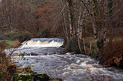 The Semme near Droux | |
| Location | |
| Country | France |
| Physical characteristics | |
| Source | |
| • location | Saint-Priest-la-Feuille |
| • coordinates | 46°11′47″N 01°32′20″E / 46.19639°N 1.53889°E / 46.19639; 1.53889 |
| • elevation | 405 m (1,329 ft) |
| Mouth | |
• location | Gartempe |
• coordinates | 46°08′42″N 01°07′12″E / 46.14500°N 1.12000°E / 46.14500; 1.12000 |
• elevation | 183 m (600 ft) |
| Length | 50.3 km (31.3 mi) |
Basin size | 177 km2 (68 sq mi) |
| Discharge | |
| • average | 2 m3/s (71 cu ft/s) |
| Basin features | |
| Progression | Loire→ Atlantic Ocean |
The Semme (French pronunciation: [sɛm]) is a 50.3-kilometre (31.3 mi) river in the Creuse and Haute-Vienne departments in central France.1 Its source is in Saint-Priest-la-Feuille. It flows generally west and is a right tributary of the Gartempe, into which it flows near le Bouchard—a hamlet in the municipality of Droux.
Departments and communes along its course
This list is ordered from source to mouth: