Saulnot | |
|---|---|
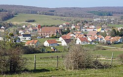 A general view of Saulnot | |
 Coat of arms | |
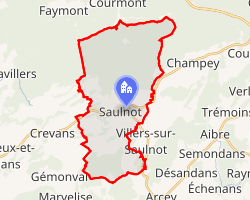 Location of Saulnot | |
Saulnot Saulnot | |
| Coordinates: 47°33′48″N 6°38′03″E / 47.5633°N 6.6342°E / 47.5633; 6.6342 | |
| Country | France |
| Region | Bourgogne-Franche-Comté |
| Department | Haute-Saône |
| Arrondissement | Lure |
| Canton | Héricourt-2 |
| Intercommunality | CC pays d'Héricourt |
Area 1 | 26.73 km2 (10.32 sq mi) |
| Population (2023)1 | 758 |
| • Density | 28.4/km2 (73.4/sq mi) |
| Time zone | UTC+01:00 (CET) |
| • Summer (DST) | UTC+02:00 (CEST) |
| INSEE/Postal code | 70477 /70400 |
| Elevation | 324–522 m (1,063–1,713 ft) |
| 1 French Land Register data, which excludes lakes, ponds, glaciers > 1 km2 (0.386 sq mi or 247 acres) and river estuaries. | |
Saulnot is a commune in the Haute-Saône department in the region of Bourgogne-Franche-Comté in eastern France. In 1973 it absorbed two former communes: Corcelles and Gonvillars.2
Coal mines operated in the village between the 16th century and 1925.
-
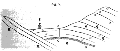 A sectional view of a mine shaft in Saulnot.
 -
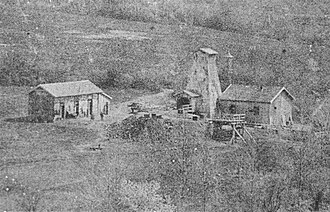 Surface infrastructure of a mine shaft in the start of 20th century.
 -
 View of an open mine shaft.
See also
See also
References
References
- "Populations de référence 2023" (in French). National Institute of Statistics and Economic Studies. 18 December 2025.
- Modifications aux circonscriptions administratives territoriales (fusion de communes), Journal officiel de la République française n° 0024, 28 January 1973, pp. 1114-1117.