Sarrewerden | |
|---|---|
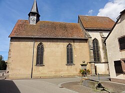 The church in Sarrewerden | |
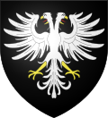 Coat of arms | |
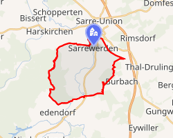 Location of Sarrewerden | |
Sarrewerden Sarrewerden | |
| Coordinates: 48°55′25″N 7°05′04″E / 48.9236°N 7.0844°E / 48.9236; 7.0844 | |
| Country | France |
| Region | Grand Est |
| Department | Bas-Rhin |
| Arrondissement | Saverne |
| Canton | Ingwiller |
| Government | |
| • Mayor (2020–2026) | Jean-Joseph Taesch1 |
Area 1 | 16.73 km2 (6.46 sq mi) |
| Population (2023)2 | 816 |
| • Density | 48.8/km2 (126/sq mi) |
| Time zone | UTC+01:00 (CET) |
| • Summer (DST) | UTC+02:00 (CEST) |
| INSEE/Postal code | 67435 /67260 |
| Elevation | 217–336 m (712–1,102 ft) |
| 1 French Land Register data, which excludes lakes, ponds, glaciers > 1 km2 (0.386 sq mi or 247 acres) and river estuaries. | |
Sarrewerden (French pronunciation: [saʁvɛʁdœn];3 German: Saarwerden) is a commune in the Bas-Rhin department in Grand Est in northeastern France.4
The localities of Bischtroff-sur-Sarre and Zollingen are incorporated in the commune since 1972.5 It gave its name to the medieval County of Saarwerden.
References
References
- "Répertoire national des élus: les maires" (in French). data.gouv.fr, Plateforme ouverte des données publiques françaises. 13 September 2022.
- "Populations de référence 2023" (in French). National Institute of Statistics and Economic Studies. 18 December 2025.
- "Localisation et prononciation des noms de lieux d'Alsace commençant par S". elsasser.free.fr. Archived from the original on 2016-10-30. Retrieved 2019-06-09.
- INSEE commune file
- Des villages de Cassini aux communes d'aujourd'hui: Commune data sheet Sarrewerden, EHESS (in French).