Sarrant | |
|---|---|
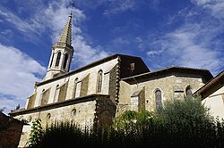 The church in Sarrant | |
 Coat of arms | |
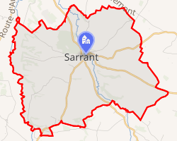 Location of Sarrant | |
Sarrant Sarrant | |
| Coordinates: 43°46′31″N 0°55′48″E / 43.7753°N 0.93°E / 43.7753; 0.93 | |
| Country | France |
| Region | Occitania |
| Department | Gers |
| Arrondissement | Condom |
| Canton | Gimone-Arrats |
| Intercommunality | Bastides de Lomagne |
| Government | |
| • Mayor (2020–2026) | Alain Berthet1 |
Area 1 | 19.81 km2 (7.65 sq mi) |
| Population (2023)2 | 358 |
| • Density | 18.1/km2 (46.8/sq mi) |
| Time zone | UTC+01:00 (CET) |
| • Summer (DST) | UTC+02:00 (CEST) |
| INSEE/Postal code | 32416 /32120 |
| Elevation | 115–192 m (377–630 ft) (avg. 130 m or 430 ft) |
| 1 French Land Register data, which excludes lakes, ponds, glaciers > 1 km2 (0.386 sq mi or 247 acres) and river estuaries. | |
Sarrant (French pronunciation: [saʁɑ̃]) is a commune in the Gers department in southwestern France. It is a member of Les Plus Beaux Villages de France (The Most Beautiful Villages of France) Association.
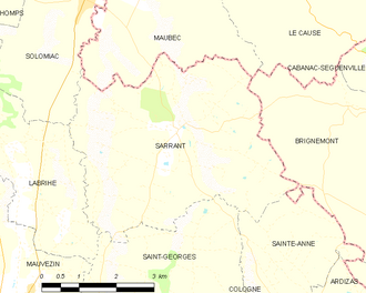
Geography
History
The Philip IV of France (1268–1314), better known as the Fair or Iron King, set up a charter of customs, which protected the inhabitants and set the living rules in the village community. The charter dated 1265, specified the rights and duties of the residents and the co-lords.3 According to the charter, consuls headed the royal castrum (fortified camp, rectangular in plan) of Sarrant and not the local Lords.
Structure
The houses of Sarrant create a ring around the central church of the village. This is not a common layout for a Bastide, because in general they were commercial enterprises and the market square was the central element of the village.4 There are many medieval and half-timbered houses in this village.
Population
| Year | Pop. | ±% p.a. |
|---|---|---|
| 1968 | 357 | — |
| 1975 | 319 | −1.59% |
| 1982 | 312 | −0.32% |
| 1990 | 319 | +0.28% |
| 1999 | 338 | +0.64% |
| 2007 | 337 | −0.04% |
| 2012 | 399 | +3.44% |
| 2017 | 368 | −1.60% |
| 2023 | 358 | −0.46% |
| Source: INSEE5 | ||
References
References
- "Répertoire national des élus: les maires" (in French). data.gouv.fr, Plateforme ouverte des données publiques françaises. 13 September 2022.
- "Populations de référence 2023" (in French). National Institute of Statistics and Economic Studies. 18 December 2025.
- "Histoire du village". Sarrant - Gers (in French). 29 July 2008. Retrieved 20 June 2016.
- "An Introduction to Bastides (PPT), at About The Bastides". John Reps Collection. Cornell University Library. Retrieved 14 June 2016.
- Population municipale entre 1968 et 2023, INSEE