Sachrang | |
|---|---|
 | |
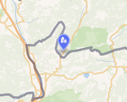 Location of Sachrang | |
Sachrang Sachrang | |
| Coordinates: 47°41′24″N 12°15′44″E / 47.69000°N 12.26222°E / 47.69000; 12.26222 | |
| Country | Germany |
| State | Bavaria |
| District | Rosenheim |
| Municipality | Aschau im Chiemgau |
| Area | |
• Total | 38.99 km2 (15.05 sq mi) |
| Elevation | 738 m (2,421 ft) |
| Population (1987) | |
• Total | 571 |
| • Density | 14.6/km2 (37.9/sq mi) |
| Time zone | UTC+01:00 (CET) |
| • Summer (DST) | UTC+02:00 (CEST) |
| Postal codes | 83229 |
| Dialling codes | 08057 |
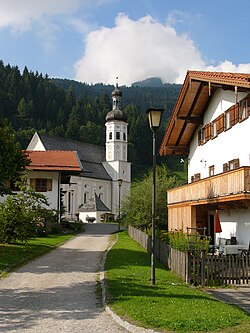
The village of Sachrang is an Ortsteil (quarter) of the municipality Aschau im Chiemgau, in Bavaria, Germany. It is located 738m above sea level.1
It is the namesake for the Sachrang Formation.
Notable people
- Werner Herzog, film director, raised in Sachrang
References
References
- "The Mountaneering village Sachrang on the Geigelstein". eng.bergsteigerdoerfer.org. Retrieved 2024-12-28.