 Route 338 | ||||
|---|---|---|---|---|
 | ||||
| Route information | ||||
| Maintained by Transports Québec | ||||
| Length | 40.9 km1 (25.4 mi) | |||
| History |  Route 2 Route 2 | |||
| Major junctions | ||||
| West end |  County Road 2 at the Ontario border County Road 2 at the Ontario border(formerly Highway 2) | |||
| Major intersections |  R-325 in Rivière-Beaudette R-325 in Rivière-Beaudette  R-201 in Coteau-du-Lac R-201 in Coteau-du-Lac A-30 in Les Cèdres A-30 in Les Cèdres | |||
| East end |  A-20 in Vaudreuil-Dorion A-20 in Vaudreuil-Dorion | |||
| Location | ||||
| Country | Canada | |||
| Province | Quebec | |||
| Major cities | Coteau-du-Lac, Vaudreuil-Dorion | |||
| Highway system | ||||
| ||||


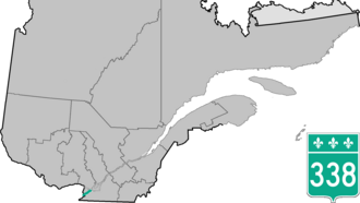
Route 338 is a provincial highway located in the Montérégie region of Quebec west of Montreal. The highway runs from the Ontario Border near Rivière-Beaudette as a continuation of Stormont, Dundas and Glengarry County Road 2 and ends in Vaudreuil-Dorion at the junction of Autoroute 20. The 338 acts as an alternate and service route parallel to A-20 although through several villages along the Saint Lawrence River. Before the 1970s, this road was named "Route 2", as part of an interprovincial Route 2 that stretched from Windsor, Ontario to Halifax, Nova Scotia.

Municipalities along Route 338
- Rivière-Beaudette
- Saint-Zotique
- Les Coteaux
- Coteau-du-Lac
- Les Cèdres
- Pointe-des-Cascades
- Vaudreuil-Dorion
Major intersections
The entire route is in Vaudreuil-Soulanges RCM.
| Location | km2 | mi | Destinations | Notes | |
|---|---|---|---|---|---|
| Rivière-Beaudette | 0.0 | 0.0 | County Road 2 west – South Glengarry, Cornwall | Continuation into Ontario; formerly Highway 2 west | |
| 2.3 | 1.4 | R-325 north – Saint-Télesphore | |||
| Saint-Zotique | 8.8 | 5.5 | 34e Avenue | ||
| Les Coteaux | 11.9 | 7.4 | Montée du Comté | ||
| Coteau-du-Lac | 14.6 | 9.1 | R-201 to A-20 – Salaberry-de-Valleyfield, Saint-Clet | Interchange | |
| 17.4 | 10.8 | Rue Principale to R-201 north – Saint-Clet | |||
| Les Cèdres | 26.7 | 16.6 | Chemin Saint-Féréol | ||
| 17.4 | 10.8 | A-30 – Vaudreuil-Dorion, Sorel-Tracy | Interchange; A-30 exit 9 | ||
| Vaudreuil-Dorion | 40.9 | 25.4 | A-20 – Toronto, Montreal | At-grade intersection | |
1.000 mi = 1.609 km; 1.000 km = 0.621 mi
| |||||
References
References
- Ministère des transports, "Distances routières", page 98, Les Publications du Québec, 2005
- "Quebec Route 338" (Map). Google Maps. Retrieved February 6, 2024.
External links
External links
- Transports Quebec Official Map Archived 2008-05-17 at the Wayback Machine (in French)
- Route 338 on Google Maps