 Route 197 | ||||
|---|---|---|---|---|
 | ||||
| Route information | ||||
| Maintained by Transports Québec | ||||
| Length | 18.5 km1 (11.5 mi) | |||
| History |  Route 6A Route 6A | |||
| Major junctions | ||||
| South end |  R-132 in Gaspé R-132 in Gaspé | |||
| North end | R-132 in Gaspé | |||
| Location | ||||
| Country | Canada | |||
| Province | Quebec | |||
| Highway system | ||||
| ||||


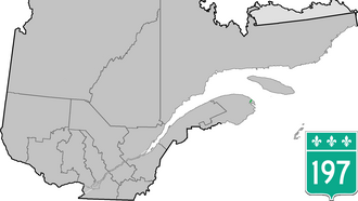
Route 197 is a short 19 km two-lane highway which cuts through the Appalachian Mountains in the municipality of Gaspé, Quebec, Canada. Its only function is to act as a shortcut to Route 132 which goes around the Forillon peninsula which makes up Forillon National Park. It starts at the junction of Route 132 in Rivière-au-Renard (part of the municipality of Gaspé) and ends again at the junction of Route 132 in Saint-Majorique, part of Gaspé as well.
Municipalities along Route 197
- Gaspé - (Rivière-au-Renard / Rivière-Morris / Saint-Majorique )
Major intersections
The entire route is in Gaspé, La Côte-de-Gaspé RCM.
| km | mi | Destinations | Notes | ||
|---|---|---|---|---|---|
| 0.0 | 0.0 | R-132 – Gaspé | Southern terminus | ||
| 18.5 | 11.5 | R-132 – Grande-Vallée, Sainte-Anne-des-Monts, Gaspé | Northern terminus | ||
| 1.000 mi = 1.609 km; 1.000 km = 0.621 mi | |||||
References
References
- Ministère des transports, "Distances routières", page 77, Les Publications du Québec, 2005
External links
External links
- Interactive Provincial Route Map (Quebec Ministry of Transportation) (in French)
- Route 197 on Google Maps