Pyeonghae
평해읍 | |
|---|---|
| Korean transcription(s) | |
| • Hangul | 평해읍 |
| • Hanja | 平海邑 |
| • Revised Romanization | Pyeonghae-eup |
| • McCune-Reischauer | P'yŏnghae-ŭp |
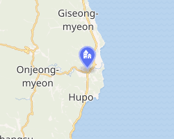 Interactive map of Pyeonghae | |
| Coordinates: 36°43′32.18″N 129°26′29.82″E / 36.7256056°N 129.4416167°E / 36.7256056; 129.4416167 | |
| Country | |
| Province | North Gyeongsang |
| County | Uljin |
| Incorporation | 1 December 1980 |
| Area | |
• Total | 37.16 km2 (14.35 sq mi) |
| Population | |
• Total | 3,798 |
Pyeonghae is a South Korean town. It is administered as part of Uljin County in North Gyeongsang Province.
Name
Pyeonghae's name means "Peaceful Sea(s)". It appears in 19th-century sources as "Pingai",1 "Pingai Harbor",2 and "Ping-hai Harbor".3
Geography
Pyeonghae lies on the north bank of the Namdae (南大川, "Southern Great River"), about a mile inland from its confluence with the Sea of Japan4 on the eastern shore of the Korean Peninsula. Its harbor was formed by a conical island, which sheltered an anchorage in the Namdae estuary.3
History
During the 19th century, Pyeonghae was reckoned one of the primary harbors on Korea's eastern shore.1
Pyeonghae Village (Pyeonghae-ri) was officially promoted to town status on 1 December 1980.
References
References
Citations
- EB (1878), p. 391.
- EB (1878), p. 390.
- King (1861), p. 381.
- US Army (1945).
Bibliography
- , Encyclopædia Britannica, vol. VI (9th ed.), New York: Charles Scribner's Sons, 1878, pp. 390–394.
- "P'yonghae-Ri", Korea 1:50,000, Ser. L751, Washington: Army Map Service, 1945.
- King, John W. (1861), The China Pilot: The Coasts of China, Korea, and Tartary..., London: J.D. Potter for the Hydrographic Office of the Admiralty.