| Plattenberg | |
|---|---|
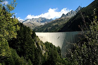 The Plattenberg (centre-left) from the Luzzone dam | |
| Highest point | |
| Elevation | 3,041 m (9,977 ft) |
| Prominence | 59 m (194 ft)1 |
| Parent peak | Vernokhörner |
| Coordinates | 46°33′29.9″N 9°1′24.3″E / 46.558306°N 9.023417°E / 46.558306; 9.023417 |
| Geography | |
Plattenberg Location in Switzerland | |
| Location | Ticino/Graubünden, Switzerland |
| Parent range | Lepontine Alps |
The Plattenberg is a mountain of the Lepontine Alps, located on the border between the Swiss cantons of Ticino and Graubünden. It lies approximately halfway between the lakes of Luzzone and Zervreila.
References
References
- Retrieved from the Swisstopo topographic maps. The key col is located north of the summit at 2,982 metres.