| Platanar Volcano | |
|---|---|
 | |
| Highest point | |
| Elevation | 2,183 metres (7,162 ft) |
| Coordinates | 10°18′00″N 84°21′58″W / 10.3000174°N 84.3660879°W / 10.3000174; -84.36608791 |
| Geography | |
Platanar Volcano Costa Rica | |
| Geology | |
| Rock age | Holocene |
| Volcano | |
| Volcanic arc | Central America Volcanic Arc |
| Last eruption | Unknown |
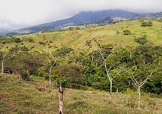
Platanar Volcano is a dormant stratovolcano located in the Cordillera Central mountain range. It is located within Juan Castro Blanco National Park.1 In 1968, 2,500 hectares (6,200 acres) on Cerro Platanar were converted into a national forest.2
Geology
Platanar sits on the north side of a complex that covers 900 square kilometres (350 sq mi)1 or approximately 386 square kilometres (149 sq mi),3 which it shares with Porvenir Volcano, another stratovolcano which also dates back to the Pleistocene1 or tentatively the Upper Pleistocene3 period. Both of these are part of a composed stratovolcano of that era.3 Platanar's summit rises to 7,162 feet (2,183 m), while Povenir's is a bit higher at 7,437 feet (2,267 m).3
There is a destroyed crater on the northwestern part of Platanar's upper region, which features on its northeastern side Palmera's collapsed caldera, probably from the Lower Pleistocene and filled mostly with lahars.3
Prehistoric lava flows adorn its western and northwestern flanks;1 one of them, the so-called Florida flow, was perhaps created by Platanar's most recent activity.4 Platanar's erupted lavas range from basalts to andesites in composition.4 On its southwest flank, there are "pyroclasts, detritus and volcanic breccias, as well as mixed breccias and alluvial deposits."4
Stream-sediment samples taken in 1987 at the base of the northern flank of Platanar Volcano may indicate "epithermal gold deposits".5
Seismic activity
On 30 March 1997 there were six earthquakes, with an epicenter 5 kilometres (3.1 mi) southeast of the volcano, the strongest being of magnitude 2.7. A previous seismic swarm in April 1980 lasted for two to three weeks.1
Economic activities
The western flanks of both volcanoes are used for dairy farming.6
References
References
- "Platanar". Global Volcanism Program. Smithsonian Institution. Retrieved 10 June 2015.
- Centro Nacional de Acción Pastoral (Costa Rica) (1990). La Montaña sagrada: una lucha por la vida (in Spanish). Centro Nacional de Acción Pastoral. p. 17. ISBN 978-9977-78-009-2.
- Jean Pierre Bergoeing (15 June 2015). Geomorphology of Central America: A Syngenetic Perspective. Elsevier Science. pp. 97–. ISBN 978-0-12-803185-8.
- Guillermo E. Alvarado Induni; Oscar Luis Chavarría-Aguilar, Guillermo E Alvarado Induni (2005). Costa Rica: Land of Volcanoes. EUNED. pp. 144–144. ISBN 978-9968-31-366-7.
- Luddington, Steve; Bagley, William C. "United States Department of the Interior Geological Survey: Follow-up examination of field areas with gold potential in Costa Rica -analytical results" (PDF). United States Geological Survey. Retrieved 19 May 2026.
- Hans Otto Spielmann (1969). Viehwirtschaft in Costa Rica: Struktur, Entwicklund und Stellung der Rinderhaltung in einem tropischen Entiwicklungsland (in German). Ludke bei der Uni. p. 210.