| Pic de Bugatet | |
|---|---|
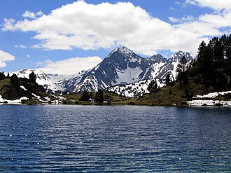 Pic de Bugatet from the north | |
| Highest point | |
| Elevation | 2,877 m (9,439 ft) |
| Coordinates | 42°48′18″N 0°10′19″E / 42.80500°N 0.17194°E / 42.80500; 0.17194 |
| Geography | |
Pic de Bugatet Location in the Pyrenees | |
| Location | Hautes-Pyrénées, France |
| Parent range | Pyrenees |
Pic de Bugatet (2,877 m) is a mountain in the Néouvielle massif in the Pyrenees, lying within the Néouvielle National Nature Reserve in the commune of Saint-Lary-Soulan within the department of the Hautes-Pyrénées.