| Great Patchogue Lake | |
|---|---|
 | |
Great Patchogue Lake Location within New York Show map of New YorkGreat Patchogue Lake Location within the United States Show map of the United States | |
| Location | Brookhaven, Suffolk County, New York |
| Coordinates | 40°46′00″N 073°01′15″W / 40.76667°N 73.02083°W / 40.76667; -73.02083 (Patchogue River (River)) |
| Ground water | |
| Patchogue River | |
| Basin countries | United States |
Surface area | 40 acres (16 ha) |
| Max. depth | 8 ft (2.4 m) |
Surface elevation | 10 ft (3.0 m) |
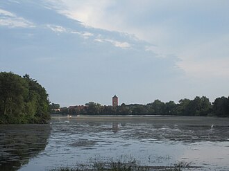
Great Patchogue Lake is located just north of Montauk Highway and is bordered by Waverly Avenue to the west and North Ocean Avenue to the east.
Patchogue Lake was dammed to provide water power for the textile industry hence its other name: Lace Mill Pond.
Today it is home to a diverse warm water fish community. Abundant perch and crappie provide plentiful fishing opportunities in the spring.
Species present (naturally reproducing):
Informal access to the lake is available from East Second Street on the west shore.
Hand launched boats are allowed; shoreline access is available but very limited.
Patchogue Lake bridge
Patchogue Lake Bridge is a concrete arch bridge over Patchogue Lake on Roe Boulevard in Patchogue.
Overview: Concrete arch bridge over Patchogue Lake on Roe Boulevard in North Patchogue Location - Suffolk County, New York Status - Open to traffic
History Built 1920 Design Arch Dimensions Length of largest span: 24.9 ft (7.6 m). Total length: 29.9 ft (9.1 m). Deck width: 39.0 ft (11.9 m). Recognition Eligible for the National Register of Historic Places