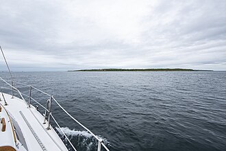
 Pasque Island from Quicks Hole | |
Location within Massachusetts Show map of MassachusettsLocation within the United States Show map of the United States | |
| Geography | |
|---|---|
| Location | Between Naushon Island and Nashawena Island |
| Coordinates | 41°27′02″N 70°49′36″W / 41.450479°N 70.826712°W / 41.450479; -70.8267121 |
| Archipelago | Elizabeth Islands |
| Total islands | 1 |
| Area | 1.333 sq mi (3.45 km2) |
| Highest elevation | 52 ft (15.8 m) |
| Administration | |
United States | |
| State | Massachusetts |
| County | Dukes County |
| Town | Gosnold |
| Demographics | |
| Population | 0 (2000) |
| Additional information | |
| Postal code | 02713 |
| Area code | 508 / 774 |
Pasque Island is one of the Elizabeth Islands of Dukes County, Massachusetts, United States. It lies between Nashawena Island to the west and Naushon Island to the east. The island has a land area of 3.45 km2 (1.333 sq mi or 853 acres) and had a population of 2 persons as of the 2000 census. [1] The island is part of the town of Gosnold, Massachusetts. It is owned by the Forbes family.
References
References
- "Pasque Island". Geographic Names Information System. United States Geological Survey, United States Department of the Interior. Retrieved August 20, 2018.